Data Products: Land Surface Temperature (Skin)
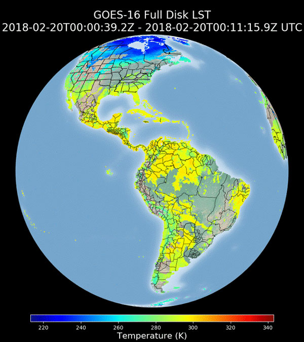
The land surface temperature (LST) product is derived from GOES-R ABI longwave infrared spectral channels and is expected to be used in a number of applications in hydrology, meteorology, and climatology. Forecasters use it to forecast the occurrence of fog and frost. The land surface product is of fundamental importance to the net radiation budget at the Earth’s surface and to monitoring the state of crops and vegetation. It is an important indicator of both the greenhouse effect and the energy flux between the atmosphere and ground. Furthermore, it can be assimilated into climate, atmospheric, and land surface models to estimate sensible heat flux and latent heat flux.