GOES-16/GOES East Data and Imagery
View additional GOES-16 imagery and data through the following webpages:
- CIMSS RealEarth: GOES-16 ABI and GLM data
- CIMSS Satellite Blog
- CIRA SLIDER GOES-16 real-time imagery
- College of DuPage GOES-16 ABI and GLM data
- NASA SPoRT real-time GOES-16 ABI data
- NASA SPoRT real-time GOES-16 GLM data
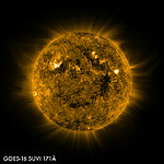
- NOAA Space Weather Prediction Center SUVI imagery
- NOAA STAR GOES East Image Viewer
- RAMMB-CIRA Satellite Library
- SSEC Geostationary Satellite Imagery: GOES-16
- UMD-CICS GLM data
GOES-16 Pre-Operational Data and Imagery
A note to the weather community about using GOES-16 data.
This section contains imagery prior to GOES-16 being declared operational. Users assume all risk related to their use of pre-operational GOES-16 data and NOAA disclaims any and all warranties, whether express or implied, including (without limitation) any implied warranties of merchantability or fitness for a particular purpose.
Local High Resolution Image Links:
This section mirrors the Flickr gallery above but contains links to only HIGH RESOLUTION LOCAL (to our server as opposed to Flickr) images. It functions as a 'one click' quick access to the highest resolution version of each image as well as back up in the event Flickr is down.
-
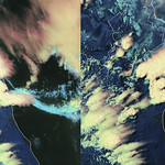
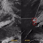
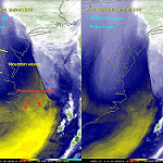
High Rez: Derecho Outflow Interacts with Sierra Madre Cloud Formation
![View HIGHEST REZ Version in new window. Derecho Outflow Interacts with Sierra Madre Cloud Formation]()
-
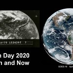
High Rez: Still Inspiring After 50 Years: Earth Day Images Then and Now
![View HIGHEST REZ Version in new window. Still Inspiring After 50 Years: Earth Day Images Then and Now]()
-
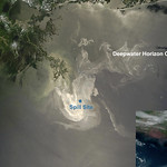
High Rez: This Day in History: Deepwater Horizon Oil Spill Occurred
![View HIGHEST REZ Version in new window. This Day in History: Deepwater Horizon Oil Spill Occurred]()
-
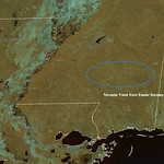
High Rez: Easter Sunday Tornado Scars Mississippi Landscape
![View HIGHEST REZ Version in new window. Easter Sunday Tornado Scars Mississippi Landscape]()
-
High Rez: GOES-East Watches Supercells Split as Powerful Storm System Moves Eastward
![View HIGHEST REZ Version in new window. GOES-East Watches Supercells Split as Powerful Storm System Moves Eastward]()
-
High Rez: GOES-East Watched North Atlantic Cyclone Pummel Iceland
![View HIGHEST REZ Version in new window. GOES-East Watched North Atlantic Cyclone Pummel Iceland]()
-
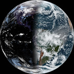
High Rez: This Year’s Vernal Equinox Is the Earliest in 124 Years
![View HIGHEST REZ Version in new window. This Year’s Vernal Equinox Is the Earliest in 124 Years]()
-
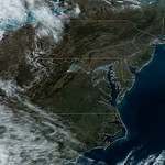
High Rez: Prescribed Burn Brings Haziness to D.C. Area
![View HIGHEST REZ Version in new window. Von Kármán Vortices Make Swirling Cloud Patterns off Canary Islands]()
-
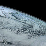
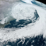
High Rez: Large Low Pressure System Swirls in the North Atlantic
![View HIGHEST REZ Version in new window. Von Kármán Vortices Make Swirling Cloud Patterns off Canary Islands]()
-
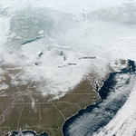
High Rez: Lake Effect Snow Dumps on the Great Lakes Region
![View HIGHEST REZ Version in new window. Von Kármán Vortices Make Swirling Cloud Patterns off Canary Islands]()
-
High Rez: Von Kármán Vortices Make Swirling Cloud Patterns off Canary Islands
![View HIGHEST REZ Version in new window. Von Kármán Vortices Make Swirling Cloud Patterns off Canary Islands]()
-
High Rez: Rain Saturates the South
![View HIGHEST REZ Version in new window. Rain Saturates the South]()
-
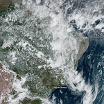
High Rez: Floods in Brazil Cause Mudslides and Property Damage
![View HIGHEST REZ Version in new window. Floods in Brazil Cause Mudslides and Property Damage]()
-
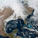
High Rez: Multiple Winter Storms Are Moving Across the U.S.
![View HIGHEST REZ Version in new window. Multiple Winter Storms Are Moving Across the U.S.]()
-
High Rez: Great Lakes Region Slammed By Severe Winter Storm
![View HIGHEST REZ Version in new window. Great Lakes Region Slammed By Severe Winter Storm]()
-
High Rez: Two Large Winter Storms to Wallop Parts of the U.S.
![View HIGHEST REZ Version in new window. Two Large Winter Storms to Wallop Parts of the U.S.]()
-
High Rez: Tropical Storm Sebastien Gradually Weakens Over the Atlantic
![View HIGHEST REZ Version in new window. Tropical Storm Sebastien Gradually Weakens Over the Atlantic]()
-
High Rez: Powerful Mid-Latitude Cyclone Forms in the North Atlantic
![View HIGHEST REZ Version in new window. Powerful Mid-Latitude Cyclone Forms in the North Atlantic]()
-
High Rez: GOES East Focuses on Dual Storm Systems
![View HIGHEST REZ Version in new window. GOES East Focuses on Dual Storm Systems]()
-
High Rez: Lorenzo Lashes Azores Islands Before Taking Aim at Ireland
![View HIGHEST REZ Version in new window. Lorenzo Lashes Azores Islands Before Taking Aim at Ireland]()
-
High Rez: GOES East Celebrates the Autumnal Equinox
![View HIGHEST REZ Version in new window. GOES East Celebrates the Autumnal Equinox]()
-
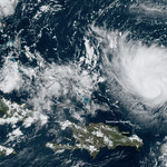
High Rez: Tropical Activity is Ramping Up This September
![View HIGHEST REZ Version in new window. Tropical Activity is Ramping Up This September]()
-
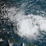
High Rez: Potential Tropical Cyclone Nine Brings Rain and Wind to the Bahamas
![View HIGHEST REZ Version in new window. Potential Tropical Cyclone Nine Brings Rain and Wind to the Bahamas]()
-
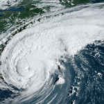
High Rez: GOES East Sees Dorian Moments Before Making Landfall Over Cape Hatteras, NC
![View HIGHEST REZ Version in new window. GOES East Sees Dorian Moments Before Making Landfall Over Cape Hatteras, NC]()
-
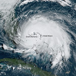
High Rez: Dorian Slows to a Crawl Over Grand Bahama
![View HIGHEST REZ Version in new window. Dorian Slows to a Crawl Over Grand Bahama]()
-
High Rez: Florida Braces for Hurricane Dorian
![View HIGHEST REZ Version in new window. Florida Braces for Hurricane Dorian]()
-
High Rez: Large Saharan Dust Plume Blows Across the Atlantic
![View HIGHEST REZ Version in new window. Large Saharan Dust Plume Blows Across the Atlantic]()
-
High Rez: A Picture of Dorian as Seen by GOES East
![View HIGHEST REZ Version in new window. A Picture of Dorian as Seen by GOES East]()
-
High Rez: GOES East Focuses On Wildfire Smoke in the Canary Islands
![View HIGHEST REZ Version in new window. GOES East Focuses On Wildfire Smoke in the Canary Islands]()
-
High Rez: NOAA Satellites Monitor Arctic Wildfires
![View HIGHEST REZ Version in new window. NOAA Satellites Monitor Arctic Wildfires]()
-
High Rez: Gulf Coast Braces for Tropical Storm Barry
![View HIGHEST REZ Version in new window. Gulf Coast Braces for Tropical Storm Barry]()
-
High Rez: Clouds Associated with Tropical Disturbance Bubble Up Over Louisiana
![View HIGHEST REZ Version in new window. Clouds Associated with Tropical Disturbance Bubble Up Over Louisiana]()
-
High Rez: Parts of Chile and Argentina Experience Total Solar Eclipse
![View HIGHEST REZ Version in new window. Parts of Chile and Argentina Experience Total Solar Eclipse]()
-
High Rez: GOES East and GOES West See Summer Solstice
![View HIGHEST REZ Version in new window. GOES East and GOES West See Summer Solstice]()
-
High Rez: Tropical Moisture Inundates Gulf Coast
![View HIGHEST REZ Version in new window. Tropical Moisture Inundates Gulf Coast]()
-
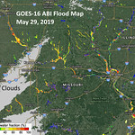
High Rez: GOES-16 Monitors Historic Flooding in the Midwest
![View HIGHEST REZ Version in new window. GOES-16 Monitors Historic Flooding in the Midwest]()
-
High Rez: Destructive Storms Prompt Tornado Emergency in Kansas
![View HIGHEST REZ Version in new window. Destructive Storms Prompt Tornado Emergency in Kansas]()
-
High Rez: Violent Tornado Rips Through Missouri’s Capital
![View HIGHEST REZ Version in new window. First Named Storm of 2019 Atlantic Hurricane Season]()
-
High Rez: First Named Storm of 2019 Atlantic Hurricane Season
![View HIGHEST REZ Version in new window. First Named Storm of 2019 Atlantic Hurricane Season]()
-
High Rez: Tornado Outbreak Possible Across Central and Southern Plains
![View HIGHEST REZ Version in new window. Tornado Outbreak Possible Across Central and Southern Plains]()
-
High Rez: More Heavy Rain Headed for Already Waterlogged Region s
![View HIGHEST REZ Version in new window. More Heavy Rain Headed for Already Waterlogged Region]()
-
High Rez: GOES East Sees Sprawling Storm System Along the East Coast
![View HIGHEST REZ Version in new window. GOES East Sees Sprawling Storm System Along the East Coast]()
-
High Rez: GOES-16 Detects East Coast Meteor
![View HIGHEST REZ Version in new window. GOES-16 Detects East Coast Meteor]()
-
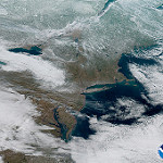
High Rez: Swath of Mid-April Snow Stretches Across Great Lakes Region
![View HIGHEST REZ Version in new window. Swath of Mid-April Snow Stretches Across Great Lakes Region]()
-
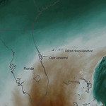
High Rez: GOES East Captures SpaceX Falcon Heavy Launch
![View HIGHEST REZ Version in new window. GOES East Captures SpaceX Falcon Heavy Launch]()
-
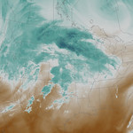
High Rez: Powerful Winter Storm Takes Aim at Plains and Upper Midwest
![View HIGHEST REZ Version in new window. Powerful Winter Storm Takes Aim at Plains and Upper Midwest]()
-
High Rez: GOES-16 Monitors Record Flooding in the Midwest
![View HIGHEST REZ Version in new window. GOES-16 Monitors Record Flooding in the Midwest]()
-
High Rez: GOES East Captures View of Vernal Equinox
![View HIGHEST REZ Version in new window. GOES East Captures View of Vernal Equinox]()
-
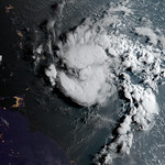
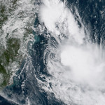
High Rez: GOES Rare Tropical Storm Forms in the South Atlantic
![View HIGHEST REZ Version in new window. Rare Tropical Storm Forms in the South Atlantic]()
-
High Rez: GOES East Snow/Cloud Layers
![View HIGHEST REZ Version in new window. GOES East Snow/Cloud Layers]()
-
High Rez: GOES East Day Cloud Phase Distinction RGB_1.24.19
![View HIGHEST REZ Version in new window. GOES East Day Cloud Phase Distinction RGB_1.24.19]()
-
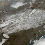
High Rez: Snow Covered U.S.
![View HIGHEST REZ Version in new window. Snow Covered U.S.]()
-
High Rez: Three Views of the Winter Solstice from GOES East
![View HIGHEST REZ Version in new window. Three Views of the Winter Solstice from GOES East]()
-
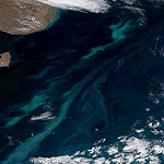
High Rez: Plankton Swirls off Argentina Coast
![View HIGHEST REZ Version in new window. Plankton Swirls off Argentina Coast]()
-
High Rez: Wettest Year on Record for Many Cities in the Eastern U.S.
![View HIGHEST REZ Version in new window. Wettest Year on Record for Many Cities in the Eastern U.S.]()
-
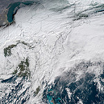
High Rez: Record December Snowfall in the Mid-Atlantic
![View HIGHEST REZ Version in new window. Record December Snowfall in the Mid-Atlantic]()
-
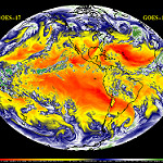
High Rez: GOES-16 and GOES-17 Mollweide Projection
![View HIGHEST REZ Version in new window. GOES-16 and GOES-17 Mollweide Projection]()
-
High Rez: Election Day Storm Brings Rain and Wind to Eastern U.S.
![View HIGHEST REZ Version in new window. Election Day Storm Brings Rain and Wind to Eastern U.S.]()
-
High Rez: Category 5 Hurricane Willa Heads Toward Mexico
![View HIGHEST REZ Version in new window. Category 5 Hurricane Willa Heads Toward Mexico]()
-
High Rez: GOES East GeoColor Imagery of Hurricane Michael (October 10, 2018)
![View HIGHEST REZ Version in new window. GOES East GeoColor Imagery of Hurricane Michael (October 10, 2018)]()
-
High Rez: Rose Forecast to Become Major Hurricane
![View HIGHEST REZ Version in new window. Rose Forecast to Become Major Hurricane]()
-
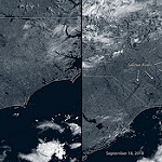
High Rez: GOES East Sees Swollen Rivers After Hurricane Florence
![View HIGHEST REZ Version in new window. GOES East Sees Swollen Rivers After Hurricane Florence]()
-
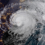
High Rez: Hurricane Florence Makes Landfall
![View HIGHEST REZ Version in new window. Hurricane Florence Makes Landfall]()
-
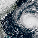
High Rez: Hurricane Florence Nears the East Coast
![View HIGHEST REZ Version in new window. Hurricane Florence Nears the East Coast]()
-
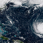
High Rez: Florence Strengthens to a Category 4 Hurricane
![View HIGHEST REZ Version in new window. Florence Strengthens to a Category 4 Hurricane]()
-
High Rez: GOES East Views Active East Pacific Tropics
![View HIGHEST REZ Version in new window. GOES East Views Active East Pacific Tropics]()
-
High Rez: The Carr and Ferguson Fires Spread Smoke Across California
![View HIGHEST REZ Version in new window. The Carr and Ferguson Fires Spread Smoke Across California]()
-
High Rez: Summer Mid-Latitude Cyclone in Central Canada
![View HIGHEST REZ Version in new window. Summer Mid-Latitude Cyclone in Central Canada]()
-
High Rez: Tropical Storm Chris, Beryl's Remnants, and More Saharan Dust over the Atlantic
![View HIGHEST REZ Version in new window. Tropical Storm Chris, Beryl's Remnants, and More Saharan Dust over the Atlantic]()
-
High Rez: GOES East Captures Saharan Dust
![View HIGHEST REZ Version in new window. GOES East Captures Saharan Dust]()
-
High Rez: GOES East Captures Wildfires in Northern California
![View HIGHEST REZ Version in new window. GOES East Captures Wildfires in Northern California]()
-
High Rez: The Summer Solstice Seen from GOES East
![View HIGHEST REZ Version in new window. The Summer Solstice Seen from GOES East]()
-
High Rez: Mid-Latitude Cyclone on the First Day of Summer
![View HIGHEST REZ Version in new window. Mid-Latitude Cyclone on the First Day of Summer]()
-
High Rez: Wildfire Smoke Blows Across the Central Rockies
![View HIGHEST REZ Version in new window. Wildfire Smoke Blows Across the Central Rockies]()
-
High Rez: GOES East Sees Hurricane Bud in the Eastern Pacific
![View HIGHEST REZ Version in new window. GOES East Sees Hurricane Bud in the Eastern Pacific]()
-
High Rez: Tropical Storm Aletta in the Eastern Pacific80607-TSAletta
![View HIGHEST REZ Version in new window. Tropical Storm Aletta in the Eastern Pacific80607-TSAletta]()
-
High Rez: Severe Thunderstorms Trigger a Meteotsunami
![View HIGHEST REZ Version in new window. Severe Thunderstorms Trigger a Meteotsunami]()
-
High Rez: GOES East Water Vapor Imagery (May 6, 2018)
![View HIGHEST REZ Version in new window. GOES East Water Vapor Imagery (May 6, 2018)]()
-
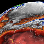
High Rez: GOES East Colorized Infrared Imagery (May 6, 2018)
![View HIGHEST REZ Version in new window. GOES East Colorized Infrared Imagery (May 6, 2018)]()
-
High Rez: April Storm Brings Wild Weather Across the U.S.
![View HIGHEST REZ Version in new window. April Storm Brings Wild Weather Across the U.S.]()
-
High Rez: May Begins Warm and Sunny in the Eastern U.S.
![View HIGHEST REZ Version in new window. May Begins Warm and Sunny in the Eastern U.S.]()
-
High Rez: East Coast Gears up for Another Nor'easter
![View HIGHEST REZ Version in new window. East Coast Gears up for Another Nor'easter]()
-
High Rez: Heavy Snowfall in the Northern Plains
![View HIGHEST REZ Version in new window. Heavy Snowfall in the Northern Plains]()
-
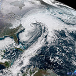
High Rez: East Coast Bomb Cyclone
![View HIGHEST REZ Version in new window. East Coast Bomb Cyclone]()
-
High Rez: Happy Winter Solstice!
![View HIGHEST REZ Version in new window. Happy Winter Solstice!]()
-
High Rez: GOES-16 is Operational as NOAA's GOES-East!
![View HIGHEST REZ Version in new window. GOES-16 is Operational as NOAA's GOES-East!]()
-
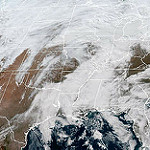
High Rez: United States Covered in Clouds
![View HIGHEST REZ Version in new window. United States Covered in Clouds]()
-
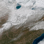
High Rez: Snow Cover in Eastern United States
![View HIGHEST REZ Version in new window. Snow Cover in Eastern United States]()
-
High Rez: Maria Makes Landfall Over Dominica
![View HIGHEST REZ Version in new window. Maria Makes Landfall Over Dominica]()
-
High Rez: Hurricane Maria Approaches the Leeward Islands
![View HIGHEST REZ Version in new window. Hurricane Maria Approaches the Leeward Islands]()
-
High Rez: GOES-16 Sees Hurricanes Katia, Irma and José
![View HIGHEST REZ Version in new window. GOES-16 Sees Hurricanes Katia, Irma and José]()
-
High Rez: GOES-16 Catches Irma's Eye over the Florida Keys
![View HIGHEST REZ Version in new window. GOES-16 Catches Irma's Eye over the Florida Keys]()
-
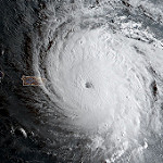
High Rez: GOES-16 Geocolor of Hurricane Irma on September 6, 2017
![View HIGHEST REZ Version in new window. GOES-16 Geocolor of Hurricane Irma on September 6, 2017]()
-
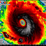
High Rez: GOES-16 Infrared of Category 5 Hurricane Irma
![View HIGHEST REZ Version in new window. GOES-16 Infrared of Category 5 Hurricane Irma]()
-
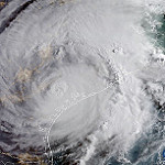
High Rez: Hurricane Harvey on August 26, 2017
![View HIGHEST REZ Version in new window. Hurricane Harvey on August 26, 2017]()
-
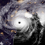
High Rez: GOES-16 Geocolor Imagery of Hurricane Harvey Just Prior to Making Landfall
![View HIGHEST REZ Version in new window. GOES-16 Geocolor Imagery of Hurricane Harvey Just Prior to Making Landfall]()
-
High Rez: GOES-16 Full Disk Geocolor of Moon's Shadow during 2017 Solar Eclipse
![View HIGHEST REZ Version in new window. GOES-16 Full Disk Geocolor of Moon's Shadow during 2017 Solar Eclipse]()
-
High Rez: Moon's Shadow Moves East of The Mississippi as seen by GOES-16 during the 2017 Solar Eclipse
![View HIGHEST REZ Version in new window. Moon's Shadow Moves East of The Mississippi as seen by GOES-16 during the 2017 Solar Eclipse]()
-
High Rez: The East Coast Disappears under the Shadow of the Moon
![View HIGHEST REZ Version in new window. The East Coast Disappears under the Shadow of the Moon]()
-
High Rez: GOES-16 Spies the Moon's Shadow over the Central Plains
![View HIGHEST REZ Version in new window. GOES-16 Spies the Moon's Shadow over the Central Plains]()
-
High Rez: GOES-16 Total Precipitable Water and Cloud Top Height
![View HIGHEST REZ Version in new window. GOES-16 Total Precipitable Water and Cloud Top Height]()
-
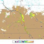
High Rez: GOES-16 Land Surface Temperature
![View HIGHEST REZ Version in new window. GOES-16 Land Surface Temperature]()
-
High Rez: GOES-16 Cloud Products
![View HIGHEST REZ Version in new window. GOES-16 Cloud Products]()
-
High Rez: Moon's Shadow Makes Landfall over the Pacific Northwest
![View HIGHEST REZ Version in new window. Moon's Shadow Makes Landfall over the Pacific Northwest]()
-
High Rez: GOES-16 Geocolor Image of Tropical Storm Harvey
![View HIGHEST REZ Version in new window. GOES-16 Geocolor Image of Tropical Storm Harvey]()
-
High Rez: SUVI Captures Large Coronal Hole Image 1
![View HIGHEST REZ Version in new window. SUVI Captures Large Coronal Hole]()
-
High Rez: SUVI Captures Large Coronal Hole Image 2
![View HIGHEST REZ Version in new window. SUVI Captures Large Coronal Hole]()
-
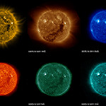
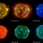
High Rez: First Solar Images from GOES-16
![View HIGHEST REZ Version in new window. First Solar Images from GOES-16]()
-
High Rez: GOES-16 and GOES-13 Water Vapor Imagery of Winter Storm
![View HIGHEST REZ Version in new window. Water Vapor Imagery of Winter Storm]()
-
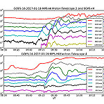
High Rez: First Data from GOES-16 SEISS Instrument
-
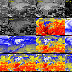
High Rez: GOES-16 16 Panel ABI
![View HIGHEST REZ Version in new window. GOES-16 16 Panel ABI]()
-
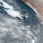
High Rez: GOES-16 ABI Africa Dust
![View HIGHEST REZ Version in new window. GOES-16 ABI Africa Dust]()
-
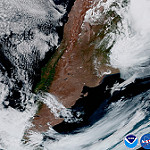
High Rez: GOES-16 ABI Argentina
![View HIGHEST REZ Version in new window. GGOES-16 ABI Argentina]()
-
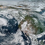
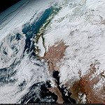
High Rez: GOES-16 ABI California
![View HIGHEST REZ Version in new window. GOES-16 ABI California]()
-
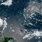
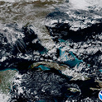
High Rez: GOES-16 ABI Caribbean
![View HIGHEST REZ Version in new window. GOES-16 ABI Caribbean]()
-
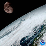
High Rez: GOES-16 ABI Moon from Geo Orbit
![View HIGHEST REZ Version in new window. GOES-16 ABI Moon from Geo Orbit]()
-
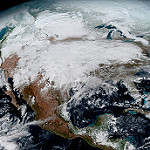
High Rez: GOES-16 North America
-
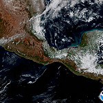
High Rez: GOES-16 ABI Yucatan
![View HIGHEST REZ Version in new window. GOES-16 ABI Yucatan]()
-
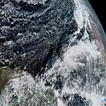
High Rez: GOES-16 ABI Full Disk
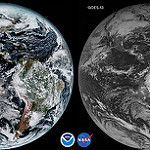
![View HIGHEST REZ Version in new window. GOES-16 ABI Full Disk]()
-
High Rez: GOES-16 and GOES-13 first day comparison
![View HIGHEST REZ Version in new window. GOES-13 first day comparison]()
-
High Rez: GOES-16 ABI Northeast Coast
![View HIGHEST REZ Version in new window. GOES-16 ABI Northeast Coast]()
-
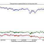
High Rez: First GOES-16 MAG Data
![View HIGHEST REZ Version in new window. First GOES-16 MAG Data]()
-
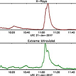
High Rez: First Data Released from GOES-16 EXIS Instrument Shows Solar Flare
![View HIGHEST REZ Version in new window. OES-16 EXIS Instrument Shows Solar Flare]()
-
High Rez: First Image from GOES-16 Lightning Mapper
![View HIGHEST REZ Version in new window. First Image from GOES-16 Lightning Mapper]()
