- Basics/Related Info
- GOES-R 101
- GOES-R: Benefits of Next-Generation Environmental Monitoring
- GOES-R Fact Sheets
- Training By Subject
- Aerosols/Air Quality/Atmospheric Composition
- Aviation
- Climate
- Clouds
- Convection
- Fire
- General Satellite Meteorology
- Hydrology
- Imagery
- Instruments
- Lightning
- Space Weather
- Winds
- By Institute


Training: COMET
Click on the thumbnail images or links below to launch/redirect to each training course.
Cooperative Program for Operational Meteorology, Education, and Training (Comet)
![]() The Cooperative Program for Operational Meteorology, Education, and Training supports, enhances, and stimulates the communication and application of scientific knowledge of the atmospheric and related sciences for the operational and educational communities. COMET’s web-based self-paced training materials serve earth science education and training needs by providing interactive experiences for learners at a distance. Experts at both the Cooperative Institute for Meteorological Satellite Studies (CIMSS) and the Cooperative Institute for Research in the Atmosphere (CIRA) contributed to many of these lessons.
The Cooperative Program for Operational Meteorology, Education, and Training supports, enhances, and stimulates the communication and application of scientific knowledge of the atmospheric and related sciences for the operational and educational communities. COMET’s web-based self-paced training materials serve earth science education and training needs by providing interactive experiences for learners at a distance. Experts at both the Cooperative Institute for Meteorological Satellite Studies (CIMSS) and the Cooperative Institute for Research in the Atmosphere (CIRA) contributed to many of these lessons.

Atmospheric Dust
Atmospheric Dust: Atmospheric dust storms are common in many of the world's semi-arid and arid regions and can impact local, regional, and even global weather, agriculture, public health, transportation, industry, and ocean health. This module takes a multifaceted approach to studying atmospheric dust storms. This module is also available in French and Spanish.

Climate Change and Extreme Weather
Climate Change and Extreme Weather: This module discusses how a changing climate can also lead to changes in extreme weather events on the local scale. The role of natural variability is also explained. The module describes how climate change can have both positive and negative effects, depending on the situation, location, and the vulnerability of the population. This module is also available in Spanish.
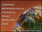
Creating Meteorological Products from Satellite Data
Creating Meteorological Products from Satellite Data: This module presents an overview of how satellite data are turned into the satellite products used by operational forecasters and the research and educational communities, etc. This module is also available in French and Spanish.
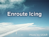
Enroute Icing
Enroute Icing: Aircraft icing has resulted in numerous accidents, some fatal. The problem is due, in part, to a lack of awareness on the part of aviation forecasters (and others) that icing is imminent. The lesson addresses this issue by presenting a process for forecasting enroute icing for aviation and applying it to a case over the Continental U.S.

GOES-R ABI
GOES-R ABI: This extension of the COMET module “GOES-R: Benefits of Next Generation Environmental Monitoring” focuses on the Advanced Baseline Imager (ABI) instrument, the satellite's 16-channel imager. The module introduces ABI's key features and improvements over earlier GOES imagers and lets users interactively explore ABI's 16 channels. It also contains movies that show the advancements that ABI will bring to a variety of applications and contains additional resources. This module is also available in Spanish.
GOES-R ABI IR Bands, Excluding Water Vapor
GOES-R ABI IR Bands, Excluding Water Vapor: This lesson introduces seven of the ten infrared imager bands on the GOES-R Series Advanced Baseline Imager, focusing on their special characteristics and how they affect what each band observes.

GOES-R ABI Near-IR Bands
GOES-R ABI Near-IR Bands: This less introduces three of the four near-infrared imager bands (at 1.37, 1.6, and 2.2 micrometers) on the GOES-R Series Advanced Baseline Imager, focusing on their special characteristics and how they affect what each band observes.

GOES-R ABI Visible and Near-IR Bands
GOES-R ABI Visible and Near-IR Bands: This lesson introduces the two visible and one near-infrared imager bands on the GOES-R Series Advanced Baseline Imager, focusing on their special characteristics and how they affect what each band observes.
GOES-R: Benefits of Next-Generation Environmental Monitoring
GOES-R: Benefits of Next-Generation Environmental Monitoring: An overview of the GOES-R mission, instruments, system and services, satellite synergy, the role of GOES-R in the Global Observing System as well as environmental monitoring section that addresses the benefits of GOES-R and the ability to monitor 13 unique hazards and phenomena. This module is also available in Spanish.
GOES-R GLM: Introduction to the Geostationary Lightning Mapper
GOES-R GLM: Introduction to the Geostationary Lightning Mapper: This extension of the COMET module "GOES-R: Benefits of Next Generation Environmental Monitoring" focuses on the Geostationary Lightning Mapper (GLM) instrument. GLM provides continuous lightning measurements over a large portion of the Western Hemisphere, mapping total lightning (intra-cloud and cloud–to–ground) flash rates and trends. This module is also available in Spanish.
GOES-R Impacts on Satellite Data Assimilation
GOES-R Impacts on Satellite Data Assimilation: This five-minute lesson presents a brief overview of how GOES-R Series observations are expected to support and potentially enhance numerical weather prediction for various analysis and forecast applications.
GOES-R/JPSS Case Exercise: Detecting and Monitoring Western US Wildfires
GOES-R/JPSS Case Exercise: Detecting and Monitoring Western US Wildfires: This lesson provides information on GOES-R and JPSS improved capabilities for detecting and monitoring wildland fires in the Western US and similar geographic regions. The California Kincade fire of October 2019 is highlighted. In this case, satellite monitoring capabilities provided useful tactical information to meteorologists who were working with fire agencies, emergency managers and first responders throughout the life of the fire. Combined with the knowledge on the ground and the tireless work of individuals who were battling the blaze, many people were effectively removed from danger and the impacts of this fire were less significant than they could have been had it not been effectively monitored using an array of tools, including satellite.
GOES-R Satellites Orientation Course
GOES-R Satellites Orientation Course: This course consists of three self-paced lessons, “GOES-R: Benefits of Next-Generation Environmental Monitoring,” “GOES-R ABI: Next Generation Satellite Imaging,” and “GOES-R GLM: Introduction to the Geostationary Lightning Mapper,” that introduces forecasters, students, researchers and other interested learners to the capabilities, products and applications anticipated with the next-generation GOES-R satellites. This module is also available in Spanish.
GOES-R Series Faculty Virtual Course
GOES-R Series Faculty Virtual Course: This webinar series provides an introduction to the new capabilities offered by the latest-generation GOES-R Series weather satellites to provide university faculty and others with a solid basis for using GOES-R/16 data in coursework and student research projects.
GOES-R Series Faculty Virtual Course: Advanced Baseline Imager
GOES-R Series Faculty Virtual Course: Advanced Baseline Imager: This course is part of a webinar series to provide university faculty and others with a solid basis for using GOES-R/16 data in coursework and student research projects. This module highlights the improved temporal, spatial, spectral and calibration attributes of the Advanced Baseline Imager (ABI) on the GOES-R Series.
GOES-R Series Faculty Virtual Course: Aviation Products
GOES-R Series Faculty Virtual Course: Aviation Products: This course is part of a webinar series to provide university faculty and others with a solid basis for using GOES-R/16 data in coursework and student research projects. This module demonstrates the capabilities of GOES-R/16 in analyzing hazards affecting the aviation industry.
GOES-R Series Faculty Virtual Course: Geostationary Lightning Mapper
GOES-R Series Faculty Virtual Course: Geostationary Lightning Mapper: This course is part of a webinar series to provide university faculty and others with a solid basis for using GOES-R/16 data in coursework and student research projects. This module highlights the capabilities of the GOES-R/16 Geostationary Lightning Mapper (GLM) in both operational and research applications and how the GLM differs from land-based lightning detection.
GOES-R Series Faculty Virtual Course: Multispectral RGB Composites
GOES-R Series Faculty Virtual Course: Multispectral RGB Composites: This course is part of a webinar series to provide university faculty and others with a solid basis for using GOES-R/16 data in coursework and student research projects. This module discusses the capabilities of the GOES-R/16 red-green-blue (RGB) composites. Multispectral or RGB composites are qualitative, false color images designed to enhance specific features in the atmosphere that are important to forecasters, aviators, mariners, and emergency response officials.
GOES-R Series Faculty Virtual Course: RapidScan Imaging
GOES-R Series Faculty Virtual Course: RapidScan Imaging: This course is part of a webinar series to provide university faculty and others with a solid basis for using GOES-R/16 data in coursework and student research projects. This module presents GOES-16/GOES-R 30-second and 1-minute rapid scan imagery to demonstrate unprecedented views of convection, wildfire, storm intensification, and other quickly-evolving features.
GOES-R Series Faculty Virtual Course: Severe Storms
GOES-R Series Faculty Virtual Course: Severe Storms: This course is part of a webinar series to provide university faculty and others with a solid basis for using GOES-R/16 data in coursework and student research projects. This module explains how GOES-R/16 can help improve forecasts of severe storms and provide forecasters with real-time information about lightning, flooding potential and other hazards.
GOES-R Series Faculty Virtual Course: Tropical Cyclones
GOES-R Series Faculty Virtual Course: Tropical Cyclones: This course is part of a webinar series to provide university faculty and others with a solid basis for using GOES-R/16 data in coursework and student research projects. This module demonstrates the GOES-R Series' new capabilities for real-time tropical cyclone analysis and monitoring, which will contribute significantly to improved hurricane track and intensity forecasts.
GOES-R Tropical to Extratropical Transition
GOES-R Tropical to Extratropical Transition: This lesson uses water vapor satellite imagery from Himawari-8 to describe the typical extratropical transition of a tropical cyclone. The Himawari-8 imager previews comparable capabilities coming online with the GOES-R Series Advanced Baseline Imager.
GOES-16 Case Exercise: 8 May 2017 Colorado Hail Event
GOES-16 Case Exercise: 8 May 2017 Colorado Hail Event This lesson harnesses GOES-16’s increased temporal and spatial resolutions to identify convective development and intensity signatures on traditional longwave IR and visible band imagery, and compares the experience to using legacy GOES products. The lesson is geared toward early-career forecasters, those forecasters wanting more experience using high-resolution satellite data to forecast convection, and will be useful to aviation forecasters, meteorology major students and instructors, and weather enthusiasts.
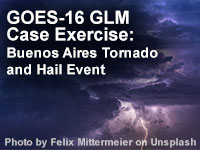
GOES-16 GLM Case Exercise: Buenos Aires Tornado and Hail Event
GOES-16 GLM Case Exercise: Buenos Aires Tornado and Hail Event: The GLM's continuous lightning monitoring capability is a valuable asset to detecting and monitoring developing thunderstorms 24 hours a day. This 30 minute lesson introduces learners to the benefits of using Geostationary Lightning Mapper (GLM) observations in assessing convection. Learners will explore a severe weather event near Buenos Aires, Argentina, and practice using GLM observations to determine initial convection, supplement other data tools in estimating tendencies in storm strength, and evaluate the potential for severe weather.
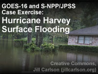
GOES-16 and S-NPP/JPSS Case Exercise: Hurricane Harvey Surface Flooding
GOES-16 and S-NPP/JPSS Case Exercise: Hurricane Harvey Surface Flooding: Satellite data are important tools for analyses and short-term forecasts of surface floodwater. This lesson highlights the August 2017 flooding associated with Hurricane Harvey in southeastern Texas, one of the most costly weather disasters in U.S. history. Through the use of interactive exercises the learner will become familiar with use and interpretation of satellite imagery in regions with surface flooding. The lesson uses data from both the S-NPP Visible Infrared Imaging Radiometer Suite (VIIRS) and the GOES-16 Advanced Baseline Imager (ABI). The satellite-derived flood map and the data that go into the flood map are both highlighted in the lesson. Examples of floodplain inundation, interbasin transfer, and water pooling in reservoirs are shown along with issues related to spatial and temporal resolution.
How Satellite Observations Impact NWP
How Satellite Observations Impact NWP: Satellite observations have a huge impact on numerical weather prediction (NWP) model analyses and forecasts. This lesson discusses the use of satellite observations in NWP and how model limitations prevent more of the data from being assimilated. Included are expected advances in NWP from GOES-R.

Impact of Satellite Observations on NWP
Impact of Satellite Observations on NWP: This lesson covers how satellite data inform numerical weather prediction models. From a basic overview of how satellite data is assimilated to how a new instrument's data might get into a model.
Introduction to Tropical Meteorology, 2nd Edition, Chapter 2: Remote Sensing
Introduction to Tropical Meteorology, 2nd Edition, Chapter 2: Remote Sensing: This chapter focuses on remote sensing—the primary method of observing weather and climate across the global tropics. We will explore how remote sensing is used and examine the types of information that it provides over formerly data-void regions. This module is also available in Spanish.
Monitoring the Climate System with Satellites
Monitoring the Climate System with Satellites: This two-hour module describes the unique role that environmental satellites play in monitoring the essential climate variables (ECVs) that are key for measuring the climate system.
Multispectral Satellite Applications: Monitoring the Wildland Fire Cycle, 2nd Edition
Multispectral Satellite Applications: Monitoring the Wildland Fire Cycle, 2nd Edition: This lesson describes current and future satellite sensors and products used for monitoring the fire cycle. Product information is presented in the context of the fire lifecycle: from assessing the pre- and post-fire environment to detecting and monitoring active fires, smoke, and aerosols. This updated version of the lesson includes new information on GOES-R fire-related applications.
Rapid Scan Applications and Benefits
Rapid Scan Applications and Benefits:This lesson introduces the capabilities and benefits of rapid scan imaging from geostationary meteorological satellites with a special focus on the current Meteosat Second Generation satellites. The lesson begins with an overview of current rapid scan imaging strategies and the products made from those observations. It then addresses nowcasting applications that benefit from these products with a focus on convection and its evolution. Other application areas that benefit from rapid scan observation are mentioned including the monitoring of fog and low stratus, wildfires, tropical cyclones, and atmospheric motion vector data. The final section describes the new and next-generation rapid scan datasets from international satellite operators around the world and improvements for advancing weather analysis and prediction.
RGB Products Explained
RGB Products Explained: This module provides an overview of meteorological and environmental RGB products, namely, how they are constructed and how to use them. This module is also available in Spanish.
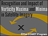
Recognition and Impact of Vorticity Maxima and Minima in Satellite Imagery
Recognition and Impact of Vorticity Maxima and Minima in Satellite Imagery: Vorticity maxima and minima signatures are common features of the atmosphere. They indicate areas of ascending and descending circulation and atmospheric forcing and can be used to diagnose dynamic features such as the axis of maximum winds and deformation zones. This module provides insight on the analysis of these dynamic atmospheric features using Meteosat Second Generation (MSG) satellite imagery.
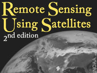
Remote Sensing Using Satellites, 2nd Edition
Remote Sensing Using Satellites, 2nd Edition: The second edition of the "Remote Sensing Using Satellites" module updates imagery of recent hurricanes as well as other phenomena from more recent satellites. Learn about remote sensing in general and then more specifically about how it is done from satellites. The lesson focuses on the visible and infrared channels, those commonly seen on television broadcasts.
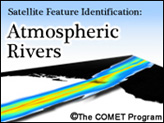
Satellite Feature Identification: Atmospheric Rivers
Satellite Feature Identification: Atmospheric Rivers: Presents the global moisture transport phenomenon known as the atmospheric river (AR). ARs are responsible for transporting the majority of maritime moisture from low to middle latitudes.
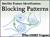
Satellite Feature Identification: Blocking Patterns
Satellite Feature Identification: Blocking Patterns: Examines how water vapor imagery can be used to help diagnose blocking patterns and their dissipation. Four major blocking patterns are covered in this module: blocking highs, cut-off lows, Rex blocks, and Omega blocks. This module is also available in French and Spanish.
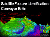
Satellite Feature Identification: Conveyor Belts
Satellite Feature Identification: Conveyor Belts: This lesson highlights important atmospheric processes that can be advantageous for making weather forecasts. In this lesson, learn to identify conveyor belts using water vapor imagery. This module is also available in French.
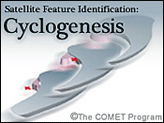
Satellite Feature Identification: Cyclogenesis
Satellite Feature Identification: Cyclogenesis: This module uses water vapor satellite imagery to present a satellite perspective of basic features associated with the formation and development of extratropical cyclones.
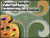
Satellite Feature Identification: Deformation Zone Analysis
Satellite Feature Identification: Deformation Zone Analysis: The quick analysis of deformation zones provides an overview of system-relative atmospheric circulations. Since deformation is a primary factor in frontogenesis and frontolysis, understanding of these system-relative circulations is crucial to the diagnosis of atmospheric processes and weather prediction. This module is also available in Spanish and French.
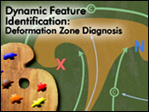
Satellite Feature Identification Deformation Zone Diagnosis
Satellite Feature Identification: Deformation Zone Diagnosis: Following an analysis of the main features of a deformation zone, the diagnosis of temporal and spatial changes in these features can be used to deduce underlying meteorological processes and their progression. In turn, this knowledge can then be used in the forecast process to adjust the forecast accordingly. This module is also available in French.
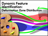
Satellite Feature Identification: Deformation Zone Distribution
Satellite Feature Identification: Deformation Zone Distribution: The distribution of vorticity centres along an axis of maximum winds follows a fairly predictable pattern based on the characteristics of the flow. By diagnosing these characteristics, the meteorologist is able to quickly deduce the location and relative intensities of the associated vorticity centres as well as the relative sizes of the associated circulations.
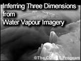
Satellite Feature Identification: Inferring Three Dimensions from Water Vapour Imagery
Satellite Feature Identification: Inferring Three Dimensions from Water Vapour Imagery: Water vapor imagery can help us break out of flatland and move to more dimensions. This imagery holds so much under-utilized potential. We can actually see three-dimensional structures evolving in near-real-time. Come see the atmosphere in 3D using water vapor imagery! This module is also available near-real-time. This module is also available in French.
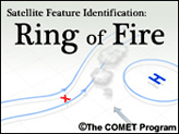
Satellite Feature Identification: Ring of Fire
Satellite Feature Identification: Ring of Fire: Introduces forecasters to the potentially damaging convection that can develop in conjunction with blocking high pressure centers and examines how to identify it from a water vapor imagery perspective. This module is also available in French and Spanish.
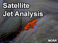
Satellite Jet Analysis
Satellite Jet Analysis: This lesson explains how to identify jets and jetstreaks using satellite water vapour imagery. It begins by finding the jetstream and synoptic longwave pattern using a set of five key identifiers. The lesson then moves on to locating jetstreaks within the jetstream using a set of four similar, refined indicators. The lesson concludes with an example where learners can synthesize all of the identification methods through analyzing all jetstreams and jetstreaks present in a single case.
Satellite Meteorology: GOES Channel Selection Version 2
Satellite Meteorology: GOES Channel Selection Version 2: This module includes significant updates to the module "Satellite Meteorology: GOES Channel Selection." It still reviews the five GOES imager channels and their use, incorporating updated technical information, conceptual visualizations and numerous imagery examples. This module is also available in Spanish.
Satellite Meteorology: Introduction to Using the GOES Sounder
Satellite Meteorology: Introduction to Using the GOES Sounder: This module, adapted for the Web from the CD-ROM released in 1998, reviews GOES sounder characteristics, data products, and applications concurrent with the GOES I(8)-P satellites. This module is also available in Spanish.
Satellite Monitoring of Atmospheric Composition
Satellite Monitoring of Atmospheric Composition: This module provides an overview of the use of satellites in monitoring of atmospheric composition to provide important information for a number of applications, including stratospheric ozone monitoring, long-range pollutant transport, biomass burning, air quality monitoring and forecasting, and climate change.
Space Weather Basics, 2nd Edition
Space Weather Basics, 2nd Edition: This module presents an overview of space weather processes, their impacts on Earth and human activities, and the technologies used for forecasting space weather events. This module is also available in Spanish.
Space Weather Impacts on Aviation
Space Weather Impacts on Aviation: This module examines the effects of solar flares, coronal mass ejections, and other solar phenomena on aviation operations. The content gives aviation forecasters and others an overview of the information and products available from NOAA's Space Weather Prediction Center and provides practice interpreting and using those products for decision support during space weather events. This module is also available in Spanish.
Volcanic Ash: Introduction
Volcanic Ash: Introduction: This introduction to a four-part series on Volcanic Ash provides a concise introduction to volcanic ash through the examples of the Mt. Pinatubo and Eyjafjallajökull eruptions. This module is also available in Spanish.
Volcanic Ash: Volcanism
Volcanic Ash: Volcanism: This module is the second in the four-part Volcanic Ash series. It provides information about the geological and geophysical processes related to volcanic activity and volcanic ash in the atmosphere and on the ground. It discusses four types of volcanic eruptions and describes six major volcanic hazards. This module is also available in Spanish.
Volcanic Ash: Impacts to Aviation, Climate, Maritime Operations, and Society
Volcanic Ash: Impacts to Aviation, Climate, Maritime Operations, and Society: This module is the third in the four-part Volcanic Ash series. It provides information on the impacts of an explosive volcanic eruption to aviation, climate, maritime operations and society. The threats, or impacts, from an eruption vary depending on the eruption style, duration and proximity--both in distance and altitude--to the volcano. This module is also available in Spanish.
Volcanic Ash: Observation Tools and Dispersion Models
Volcanic Ash: Observation Tools and Dispersion Models: This module is the fourth and final entry in the Volcanic Ash series. It covers the tools and techniques used for identifying and forecasting the transport of volcanic ash. This module is also available in Spanish.
Weather Decision Support for the National Airspace System
Weather Decision Support for the National Airspace System: This three-hour lesson describes the impacts of weather on aviation operations and highlights the role of the National Weather Service (NWS) in supporting the Federal Aviation Administration's air traffic management organization.