- Basics/Related Info
- GOES-R 101
- GOES-R: Benefits of Next-Generation Environmental Monitoring
- GOES-R Fact Sheets
- Training By Subject
- Aerosols/Air Quality/Atmospheric Composition
- Aviation
- Climate
- Clouds
- Convection
- Fire
- General Satellite Meteorology
- Hydrology
- Imagery
- Instruments
- Lightning
- Space Weather
- Winds
- By Institute


Training: Aviation
Click on the thumbnail images or links below to launch/redirect to each training course.
Cooperative Program for Operational Meteorology, Education, and Training (Comet)
![]() The Cooperative Program for Operational Meteorology, Education, and Training supports, enhances, and stimulates the communication and application of scientific knowledge of the atmospheric and related sciences for the operational and educational communities. COMET’s web-based self-paced training materials serve earth science education and training needs by providing interactive experiences for learners at a distance. Experts at both the Cooperative Institute for Meteorological Satellite Studies (CIMSS) and the Cooperative Institute for Research in the Atmosphere (CIRA) contributed to many of these lessons.
The Cooperative Program for Operational Meteorology, Education, and Training supports, enhances, and stimulates the communication and application of scientific knowledge of the atmospheric and related sciences for the operational and educational communities. COMET’s web-based self-paced training materials serve earth science education and training needs by providing interactive experiences for learners at a distance. Experts at both the Cooperative Institute for Meteorological Satellite Studies (CIMSS) and the Cooperative Institute for Research in the Atmosphere (CIRA) contributed to many of these lessons.
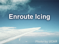
Enroute Icing
Enroute Icing: Aircraft icing has resulted in numerous accidents, some fatal. The problem is due, in part, to a lack of awareness on the part of aviation forecasters (and others) that icing is imminent. The lesson addresses this issue by presenting a process for forecasting enroute icing for aviation and applying it to a case over the Continental U.S.
GOES-R Series Faculty Virtual Course: Aviation Products
GOES-R Series Faculty Virtual Course: Aviation Products: This course is part of a webinar series to provide university faculty and others with a solid basis for using GOES-R/16 data in coursework and student research projects. This module demonstrates the capabilities of GOES-R/16 in analyzing hazards affecting the aviation industry.
Volcanic Ash: Introduction
Volcanic Ash: Introduction: This introduction to a four-part series on Volcanic Ash provides a concise introduction to volcanic ash through the examples of the Mt. Pinatubo and Eyjafjallajökull eruptions. This module is also available in Spanish.
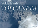
Volcanic Ash: Volcanism
Volcanic Ash: Volcanism: This module is the second in the four-part Volcanic Ash series. It provides information about the geological and geophysical processes related to volcanic activity and volcanic ash in the atmosphere and on the ground. It discusses four types of volcanic eruptions and describes six major volcanic hazards. This module is also available in Spanish.
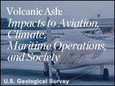
Volcanic Ash: Impacts to Aviation, Climate, Maritime Operations, and Society
Volcanic Ash: Impacts to Aviation, Climate, Maritime Operations, and Society: This module is the third in the four-part Volcanic Ash series. It provides information on the impacts of an explosive volcanic eruption to aviation, climate, maritime operations and society. The threats, or impacts, from an eruption vary depending on the eruption style, duration and proximity--both in distance and altitude--to the volcano. This module is also available in Spanish.
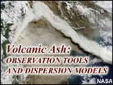
Volcanic Ash: Observation Tools and Dispersion Models
Volcanic Ash: Observation Tools and Dispersion Models: This module is the fourth and final entry in the Volcanic Ash series. It covers the tools and techniques used for identifying and forecasting the transport of volcanic ash. This module is also available in Spanish.
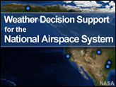
Weather Decision Support for the National Airspace System
Weather Decision Support for the National Airspace System: This three-hour lesson describes the impacts of weather on aviation operations and highlights the role of the National Weather Service (NWS) in supporting the Federal Aviation Administration's air traffic management organization.
NASA’s Short-term Prediction Research and Transition Center (SPoRT)
![]() NASA’s Short-term Prediction Research and Transition Center (SPoRT) provides training about specific products, discussing the strengths and weaknesses, with the goal of successfully transitioning products to operations. This training is built from surveys and direct communication with our partners. With this paradigm, the forecasters are an integral component of the transition process and not a passive recipient of data.
NASA’s Short-term Prediction Research and Transition Center (SPoRT) provides training about specific products, discussing the strengths and weaknesses, with the goal of successfully transitioning products to operations. This training is built from surveys and direct communication with our partners. With this paradigm, the forecasters are an integral component of the transition process and not a passive recipient of data.
Ash RGB
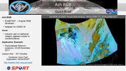
Ash RGB: This micro-lesson demonstrates the value of the Ash RGB for an eruption event near Mexico City. The ash from the Popocatepetl volcano is more easily seen via the combination of infrared channels into an RGB imagery product verses a single channel or channel difference. The RGB adds value by better differentiating ash from other cloud or surface features. The RGB components are explained and a basic interpretation of the resulting colors within the image is provided.

Aviation Forecasting RGB Products
Aviation Forecasting RGB Products: This eight-minute micro-lesson reviews some specific utilities of the nighttime microphysics RGB, the hybrid LEO/GEO fog and low cloud product, and the VIIRS day-night Band RGB relative to aviation weather forecasting. Included are a review of each of the products, as well as examples on their use individually and in tandem to help improve fog and low cloud forecasting for terminal aerodome forecasts (TAFs) and other aviation requirements.
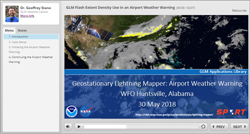
GLM Flash Extent Density use in an Airport Weather Warning
GLM Flash Extent Density use in an Airport Weather Warning: This micro-lession highlights the use f the Geostationary Lightning Mapper (GLM) Flash Extent Density product during an operational use to produce an airport weather warning.
Valley fog through mid/high clouds in Southern Appalachians
Valley fog through mid/high clouds in Southern Appalachians: This 8-minute micro-lesson demonstrates the value of multispectral (i.e. RGB imagery) to the analysis of fog and low clouds in valleys of the southern Appalachians, particularly compared to channel differencing.
Virtual Institute for Satellite Integration Training (VISIT)
 Virtual Institute for Satellite Integration Training (VISIT) is a joint effort involving NOAA Cooperative Institutes, the National Environmental Satellite Data and Information Service (NESDIS), and the National Weather Service (NWS). The primary mission of VISIT is to accelerate the transfer of research results based on atmospheric remote sensing data into NWS operations using distance education techniques. Training sessions include topics on satellite meteorology, severe weather, climate, numerical weather prediction, and more.
Many of these modules were developed in collaboration with the Cooperative Institute for Meteorological Satellite Studies (CIMSS) and the Cooperative Institute for Research in the Atmosphere (CIRA). VISIT also provides satellite chats to demonstrate satellite products that can be applied to operational forecasting and identify new training topics based on specific participant needs. See the VISIT Training Calendar for upcoming teletraining sessions.
Virtual Institute for Satellite Integration Training (VISIT) is a joint effort involving NOAA Cooperative Institutes, the National Environmental Satellite Data and Information Service (NESDIS), and the National Weather Service (NWS). The primary mission of VISIT is to accelerate the transfer of research results based on atmospheric remote sensing data into NWS operations using distance education techniques. Training sessions include topics on satellite meteorology, severe weather, climate, numerical weather prediction, and more.
Many of these modules were developed in collaboration with the Cooperative Institute for Meteorological Satellite Studies (CIMSS) and the Cooperative Institute for Research in the Atmosphere (CIRA). VISIT also provides satellite chats to demonstrate satellite products that can be applied to operational forecasting and identify new training topics based on specific participant needs. See the VISIT Training Calendar for upcoming teletraining sessions.
VISIT Training Sessions:
VISIT offers a wide selection of satellite remote sensing training materials. See the VISIT Training Sessions webpage for a complete listing.
FDTD Satellite Application Webinars:
The National Weather Service Forecast Decision Training Division (FDTD) Satellite Application Webinars are peer-to-peer learning; staff from Weather Forecast Offices (WFOs), National Centers, Center Weather Service Units (CWSUs), and River Forecast Centers (RFCs) lead the presentations. The webinars to share how to apply GOES imagery with other datasets for a specific operational application.