GOES-R Series News | 2026
-
April 7, 2026: Earth From Orbit: One Year of GOES-19 as GOES East
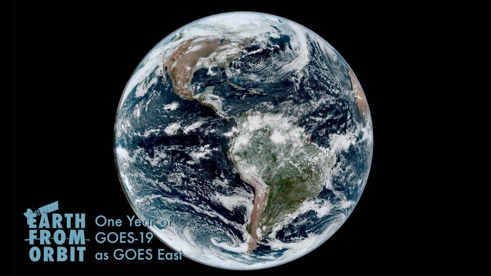
April 7, 2026, marks the one-year anniversary of NOAA’s GOES-19 entering service as GOES East, watching over the Western Hemisphere. In this role, GOES-19 is NOAA’s primary geostationary satellite for detecting and monitoring weather and environmental phenomena that affect the contiguous United States, driving short-term forecasts and warnings. During its first year of operation, GOES-19 provided critical data for a number of high-impact events across the country, from powerful hurricanes and severe storms to wildfires, dust storms, exploding meteors, and solar eruptions.
April
-
January 30, 2026: Earth from Orbit: NOAA Satellites Monitor Massive Winter Storm
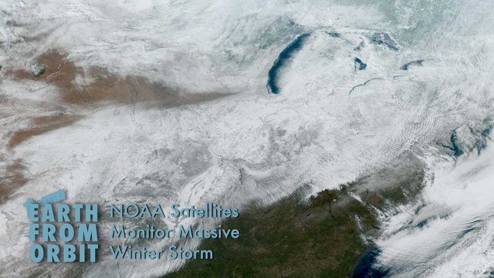
In late January 2026, NOAA’s satellites monitored a massive winter storm that swept across the U.S. and brought heavy snow, ice, and dangerous cold. The winter storm caused hazardous travel conditions, widespread power outages, and major disruptions to air and ground transport. A surge of Arctic air followed the storm, and plunged parts of the central and eastern U.S. into extreme cold. GOES East and GOES West tracked the low-pressure system off the West Coast that produced the massive storm as well as the storm itself. The satellites monitored clouds and atmospheric conditions in near-real time, allowing forecasters to track rapidly-changing weather conditions, determine how fast wind speeds would be at various levels of the atmosphere, identify when the storm was becoming severe, and predict where the storm would move.