This website will be retired on Sept. 30, 2026.
Beginning Oct. 1, 2026, please visit https://www.nesdis.noaa.gov/our-satellites/currently-flying/geostationary-satellites for GOES-R Program content.
Data Products: Volcanic Ash Detection and Height
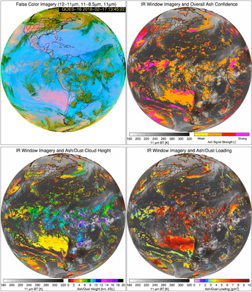
The volcanic ash product algorithm utilizes five GOES-R ABI infrared channels to automatically determine the height and mass loading properties of any pixel found to contain volcanic ash. Forecasters can use the volcanic ash product to identify areas where volcanic ash is present and potentially hazardous, and ultimately, issue more accurate aviation, air quality, and public health warnings. The volcanic ash product is useful for initializing dispersion models and volcanic ash trajectory prediction models. The more accurate mass loading detection may also aid in forecasting short-term climate changes due to volcanic eruptions.