This website will be retired on Sept. 30, 2026.
Beginning Oct. 1, 2026, please visit https://www.nesdis.noaa.gov/our-satellites/currently-flying/geostationary-satellites for GOES-R Program content.
Data Products: Low Cloud and Fog
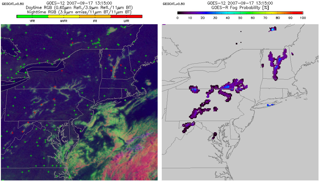
The low cloud and fog product algorithm will use GOES-R ABI spatial and spectral information to identify fog/low stratus clouds. The algorithm is capable of both day and night detection. Fog/low cloud depth is calculated for pixels positively identified by the fog mask. The higher resolution of the GOES-R ABI provides a much more detailed image of low clouds and fog over any given area. Forecasters will be able to issue important fog advisories and warnings, pertinent to commuters and the aviation community alike. More accurate warnings will help reduce the number of automobile and aircraft accidents due to fog.