GOES-R Series News | 2021
December
December 10, 2021: The Top 10 of 2021: A Year from NOAA Satellites
With their lofty view from space, NOAA satellites see the awe-inspiring beauty and the sobering destruction Mother Nature creates across our dynamic planet—and 2021 provided an eyeful. NOAA satellites caught monster hurricanes, severe thunderstorms, raging wildfires, erupting volcanoes, and even some celestial displays. Review the Top 10 list.
December 13, 2021: GOES-T mission overview video
NOAA is about to launch a new satellite into orbit above Earth, which will be third in the fleet of the agency's latest generation of Geostationary Operational Environmental Satellites (GOES). This is the most advanced weather observing and environmental monitoring system in the Western Hemisphere. GOES-T, which will be renamed GOES-18 once in orbit, is scheduled to launch on March 1, 2022. Following a successful on-orbit checkout of its instruments and systems, GOES-18 will go into operational service as GOES West. In this position, the satellite will provide critical data for the U.S. West Coast, Alaska, Hawaii, Mexico, Central America, and the Pacific Ocean.
December 10, 2021: Earth from Orbit: Kona Low Slams Hawaii
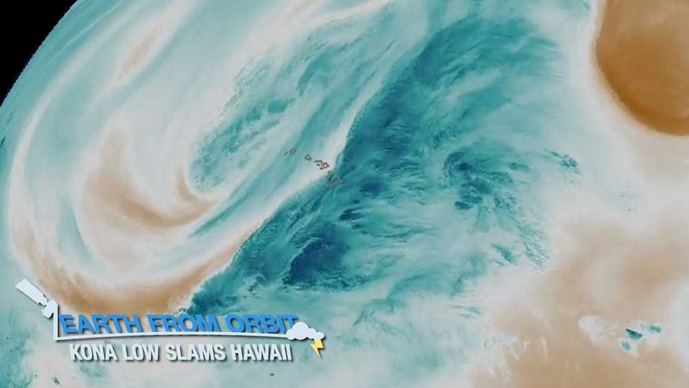
NOAA satellites monitored a large “kona low” storm system that brought drenching rain, flash flooding, and blizzard conditions to Hawaii. The system moved directly over the islands on Dec. 4, 2021, prompting Hawaii’s governor to declare a state of emergency. A kona low, or kona storm, is a seasonal subtropical cyclone that occurs in Hawaii during the winter months.
December 2, 2021: Earth from Orbit: 2021 Hurricane Season Comes to a Close
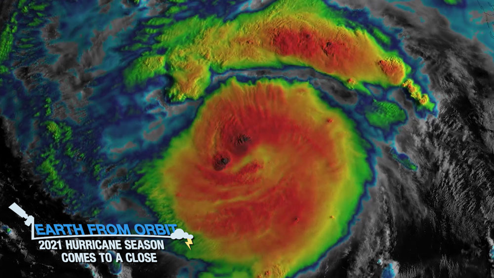
The 2021 Atlantic Hurricane Season officially came to a close on Nov. 30 and was the third-busiest Atlantic season on record. This year, a total of 21 named storms formed, seven of which became hurricanes. Of these, four were considered major (Category 3 or above) on the Saffir-Simpson Hurricane Wind Scale. NOAA satellites monitored and tracked all of the storms, providing vital data to safeguard communities. Read more about this season as well as how NOAA’s early forecasts helped safeguard communities.
-
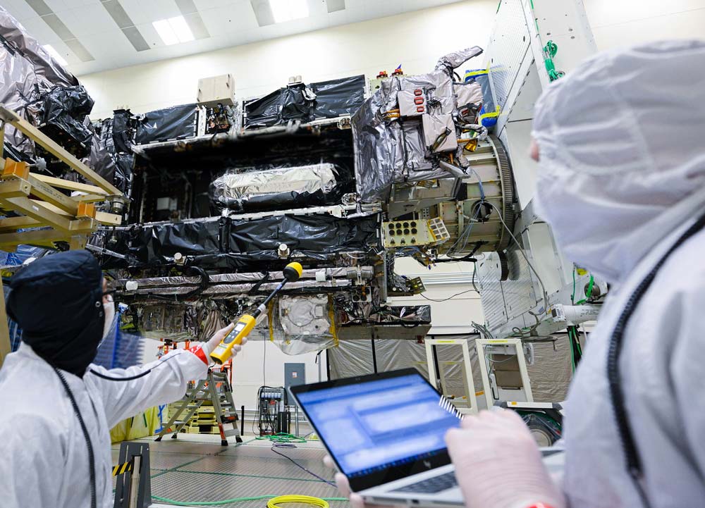
November 18, 2021: Earth from Orbit: GOES-T Arrives at Kennedy Space Center
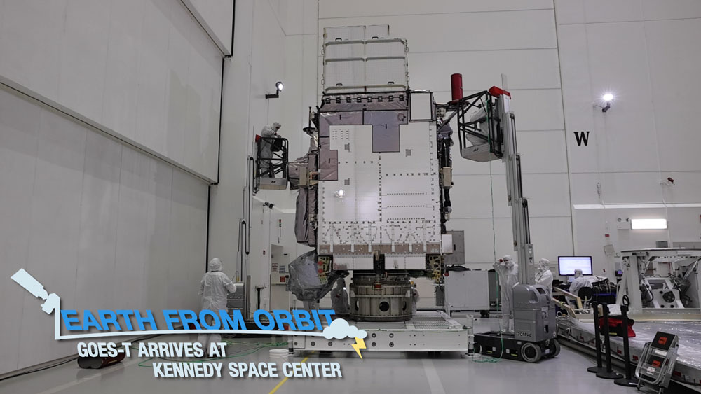
GOES-T arrived at Kennedy Space Center on Nov. 10, 2021, and now resides at the Atrotech Space Operations satellite processing facility, where it will undergo final preparations for launch. Credit: NASA/Liz Wilk NOAA’s GOES-T, the third in the GOES-R Series of advanced weather observing and environmental monitoring satellites, arrived in Florida on Nov. 10, 2021 to begin final preparations for launch, which is currently scheduled for March 1, 2022. Watch its journey from Colorado to Florida in the latest installment of our Earth from Orbit video series.
-
November 18, 2021: NOAA’s GOES-T Has New Launch Date
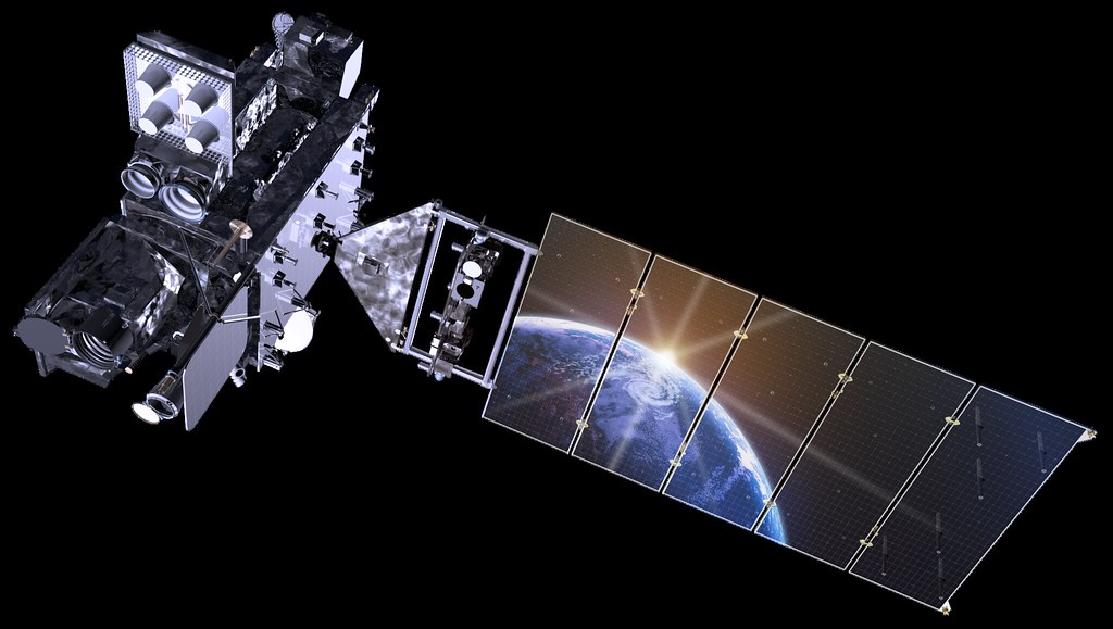
GOES-R Spacecraft With Earth Reflection NOAA and NASA are now targeting March 1, 2022, for the launch of GOES-T satellite. The launch was recently scheduled for February 16, 2022. However, shifts in launch dates for missions scheduled ahead of GOES-T prompted NASA, NOAA, and United Launch Alliance (ULA) to coordinate the new date.
-
November 10, 2021: GOES-T Arrives in Florida Ahead of 2022 Launch
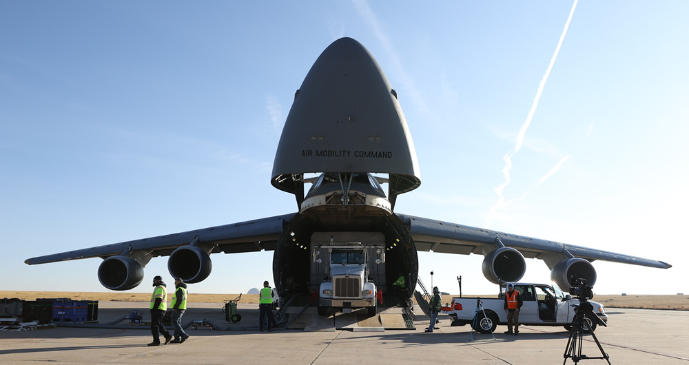
GOES-T is loaded onto the C-5 Super Galaxy aircraft that will take it to Kennedy Space Center in Florida. Photo Credit: Lockheed Martin. NOAA’s GOES-T, the third in the GOES-R Series of advanced weather observing and environmental monitoring satellites, arrived in Florida on Nov. 10, 2021 to begin final preparations for an early 2022 launch. Shipping a satellite is no small feat. GOES-T is the size of a small school bus and weighs over 6,000 pounds! The spacecraft team at Lockheed Martin in Littleton, Colorado, where GOES-T was built, carefully packed the satellite in a special shipping container that protected its sensitive instruments and functioned as a miniature clean room during transport. GOES-T was then driven to Buckley Space Force Base in Aurora, Colorado, where it hitched a ride aboard a C-5 Super Galaxy aircraft to Kennedy Space Center.
-
November 8, 2021: GOES-T: Road to Launch
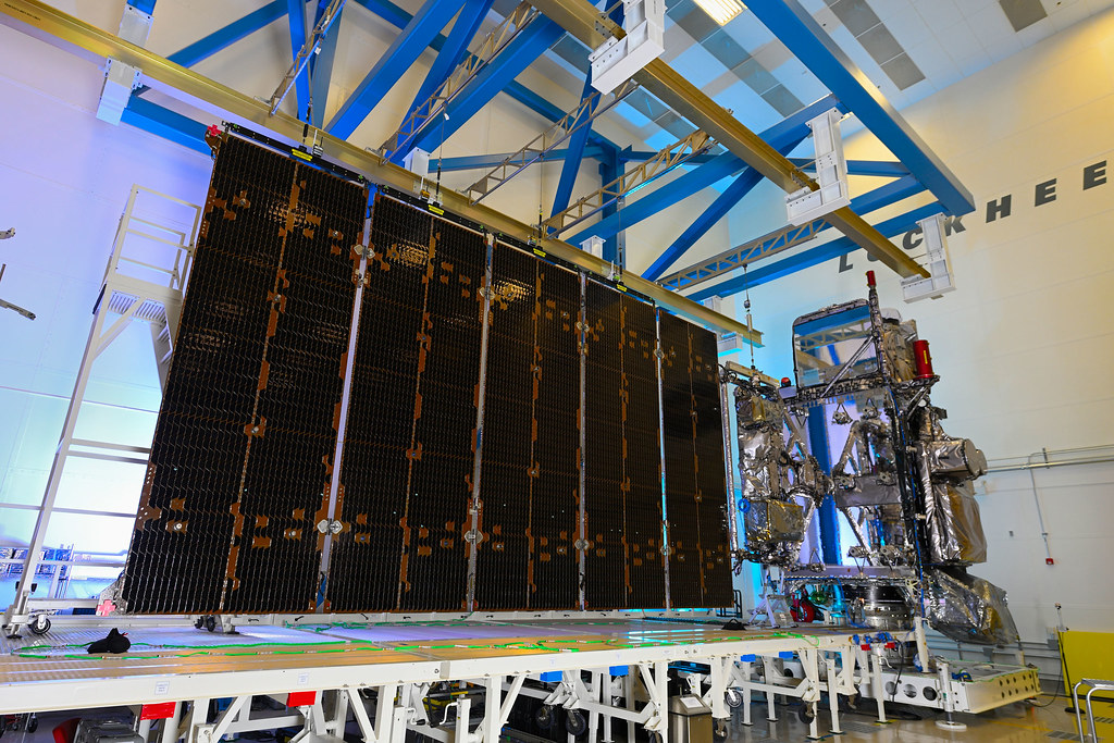
GOES-T satellite with solar array extended. Credit: Lockheed Martin The GOES-T satellite team has spent years building the instruments and spacecraft, integrating all of the satellite’s components, and conducting rigorous testing to make sure it can withstand the harsh conditions of launch and residing 22,236 miles above Earth. So, it’s time to launch it into space, right? Not quite yet! Learn more about the final steps GOES-T will undergo in preparation for a February 2022 launch.
-
November 8, 2021: GOES-R participates in Vice President Harris’ visit to NASA Goddard Space Flight Center
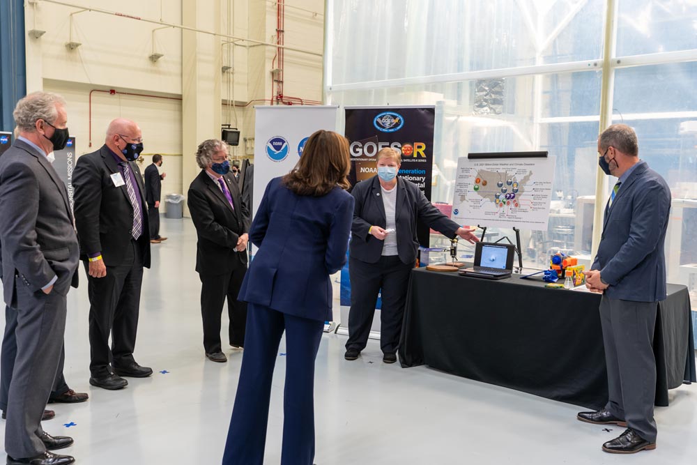
GOES-R system program director Pam Sullivan showcases GOES-16 imagery for Vice President Kamala Harris. Photo credit: NASA/Taylor Mickal The urgency of Earth science and climate studies took the spotlight Friday, Nov. 5, as Vice President Kamala Harris visited NASA’s Goddard Space Flight Center in Greenbelt, Maryland. The vice president received a first-hand look at how the nation’s space program studies climate change and provides crucial information to understand our planet’s changes and their impacts on our lives. The six-decade NOAA-NASA partnership was highlighted during the tour, including a GOES-R Program presentation by system program director Pam Sullivan that emphasized the essential data the satellites provide for accurate and timely forecasts that save lives and help people adapt to climate change. Additional photos of the visit available via the NASA Goddard Flickr page.
-
November 4, 2021: Earth from Orbit: Solar Flare Erupts
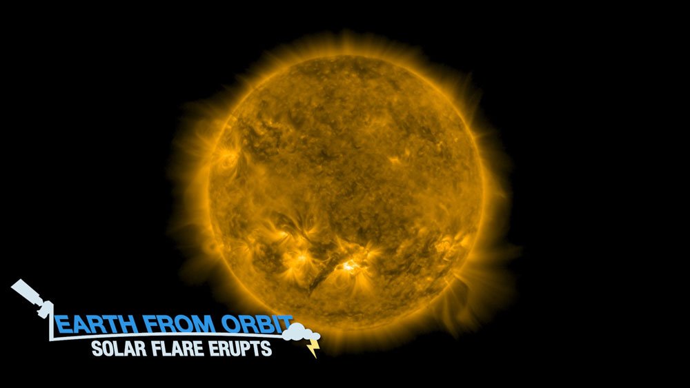
On Oct. 28, NOAA’s GOES East satellite observed a strong solar flare with its Solar Ultraviolet Imager (SUVI). The flare produced aurora that was visible across parts of the northern U.S. Learn more in this week's Earth from Orbit: Solar Flare Erupts.
-
November 3, 2021: NOAA's GOES-16 Played a Key Role in Hurricane Ida's Tricky Forecast
In Hurricane Ida, NOAA’s GOES-16 saw more than meets the eye—literally! Two NOAA experts discuss how the satellite’s advanced technology provided critical information about this devastating storm.
November
-
October 29, 2021: 5 Haunting Sights from NOAA Satellites
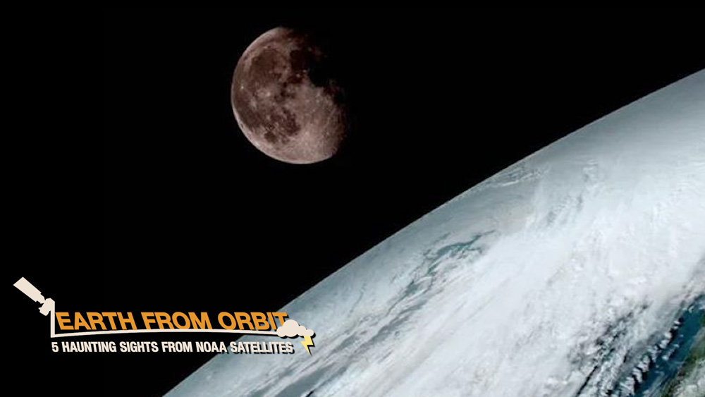
NOAA satellites have a boo-tiful view of Earth, 24/7. Sometimes they see some haunting sights, like moon glint or the moon creeping near the edge of Earth. When monitoring hurricanes, GOES satellites have captured eerie imagery that looks skulls in these monster storms. Graveyards are home to ghosts and ghouls, not satellites. But when a GOES satellite reaches its end of life, it’s sent to what’s called a graveyard orbit, out of the way of busier operational orbits. Finally, we ain’t afraid of no GOES-Ts. We’re excited for the upcoming launch of the latest sequel in the GOES-R Series. Happy Halloween from NOAA Satellites!
-
October 25, 2021: Atmospheric River Hits the West Coast
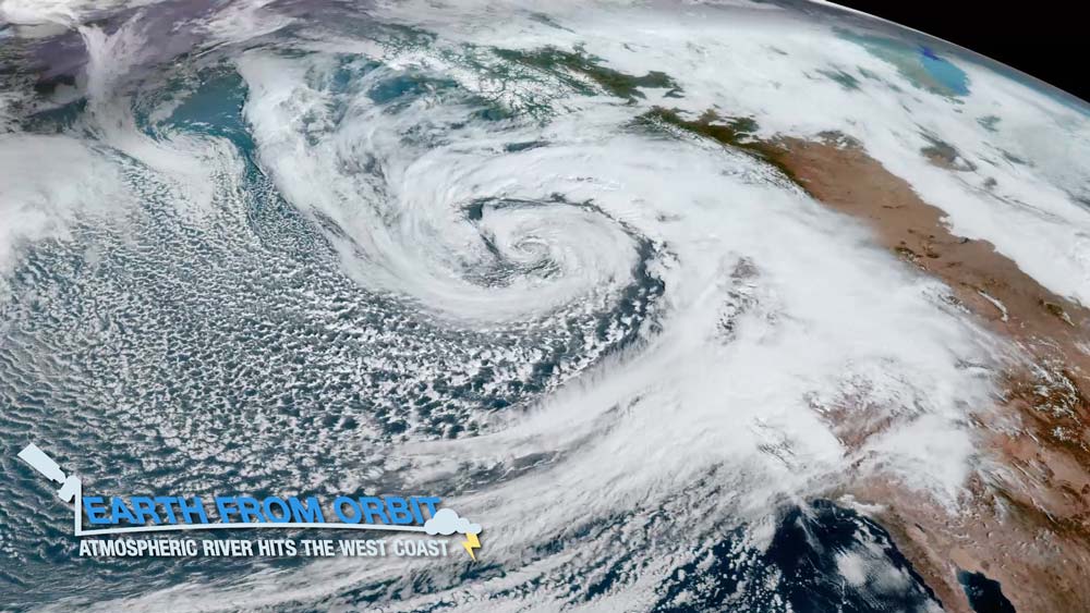
On October 25, 2021, a phenomenon called an “atmospheric river” dumped heavy rain and mountain snow across the Western U.S. and Canada. Atmospheric rivers are long, narrow belts of moisture that move through the atmosphere. They can deliver large amounts of rain, and high-elevation snow. This deluge of rain can help end droughts but also can produce flash flooding and mudslides in some areas. NOAA satellites monitor these rivers in the sky as they make their way over the West Coast.
-
October 13, 2021: Third Quarter 2021 GOES-R/GeoXO Newsletter

GOES-T after completing environmental testing. Credit: Lockheed Martin The GOES-R/GeoXO quarterly newsletter for July – September 2021 is now available. After successful Pre-Shipment and Operational Readiness Reviews, GOES-T is ready to ship to the Cape and is on track for a Feb. 16, 2022 launch. GOES-U also had a big quarter, completing the Advanced Baseline Imager (ABI) environmental test program and selecting the launch vehicle, this time a Falcon Heavy. Meanwhile, our GeoXO team completed Key Decision Point A and is preparing for the Milestone 1 review, which will formally initiate the new program. GeoXO also awarded Phase A study contracts for the Sounder instrument, starting us on the path to make hyperspectral sounding operational over the U.S. for the first time and leading to improved forecasting. Another highlight this quarter was the first-ever GOES-R Hackathon, during which teams of college students developed innovative solutions to contemporary environmental issues using GOES-R Series satellite data. The first-place team developed a smart phone app that uses GOES-R data to 3D print images of storms, hurricanes and other natural phenomena.
-
October 6, 2021: GOES-R Hackathon Inspires Innovative Solutions to Environmental Challenges
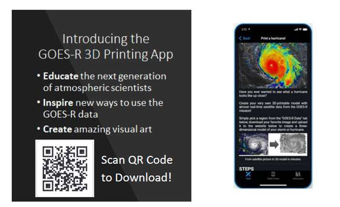
A GOES-R 3D printing app won top prize at the hackathon. The GOES-R Program conducted its first-ever hackathon from Sept. 24-26, 2021. During this virtual event, teams of college students collaborated to develop interdisciplinary solutions to contemporary environmental issues using GOES-R Series satellite data. The teams had 48 hours to complete one of five challenges and submit a video presentation. A team of NOAA scientists judged the submissions on creativity and out-of-the-box innovative solutions, feasibility, and thoughtful use of GOES-R products and/or synthesis with external data sources. The first-place team developed an app to allow users to use GOES-R satellite data to 3D print images of storms, hurricanes and other natural phenomena.
October
-
September 30, 2021: Earth from Orbit: Hurricane Sam Powers Across the Atlantic
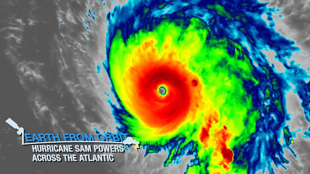
As Hurricane Sam churns in the Atlantic Ocean, NOAA satellites are carefully monitoring the powerful Category 4 storm, the strongest of the 2021 Atlantic hurricane season to date. Sam formed on Sept. 23 and rapidly intensified into a Category 4 hurricane by Sept. 25. Sam’s rate of intensification was the highest on record that far east in the Atlantic this late in the calendar year. Satellite observations showed convective bursts and the presence of a defined, stable eye during rapid intensification. Significant lightning activity was also seen within the eyewall as Sam rapidly intensified. Despite several fluctuations in intensity, Sam has maintained major hurricane strength since Sept. 25.
-
September 30, 2021: NOAA’s GOES-T launch date shifts to Feb. 16, 2022

NOAA and NASA are now targeting Feb. 16, 2022, for the launch of GOES-T satellite. The launch was previously planned for Jan. 8, 2022. Changes to launch dates in missions scheduled ahead of GOES-T prompted NASA, NOAA, and United Launch Alliance (ULA) to coordinate the new target date to optimize launch schedules for missions flying from Space Launch Complex-41.
-
September 16, 2021: Earth from Orbit: Atlantic Hurricane Season Hits Its Peak
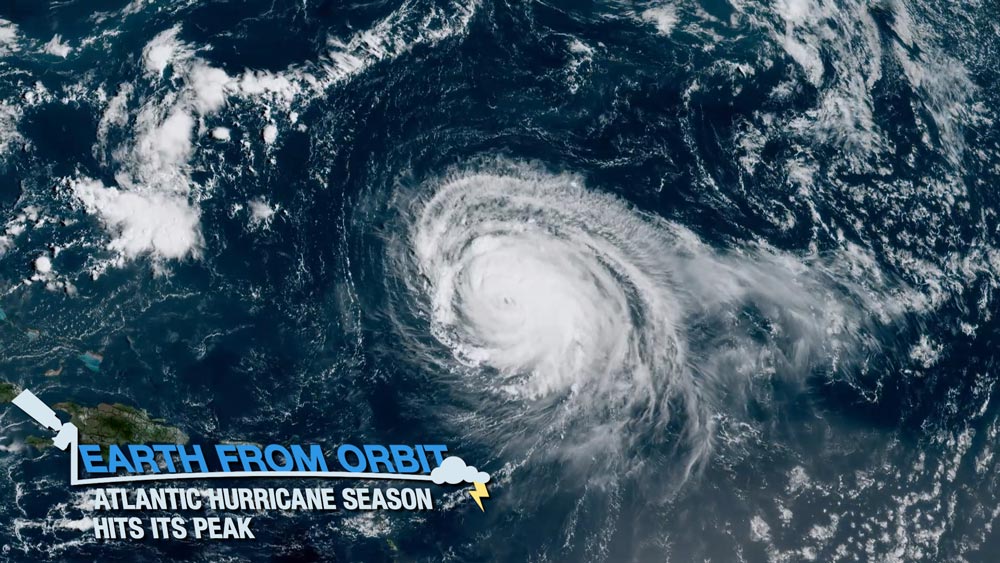
September 10 marked the peak of the Atlantic hurricane season. Climatologists determined this peak date by recording the total number of named storms in the Atlantic basin over the last 100 hurricane seasons and taking an average of when the most storms occur. Around 75% of Atlantic seasons since the beginning of the satellite era in 1966 have had at least one named storm on September 10 and about 50% of seasons have had at least one active hurricane on that date. Tropical activity tends to peak around this time because of warmer Atlantic Ocean temperatures and weaker wind shear. NOAA satellites recently monitored several storms in the Atlantic during hurricane season’s peak.
-
September 10, 2021: NASA Awards Launch Services Contract for GOES-U Mission
On Sept. 10, 2021, NASA announced that it has selected Space Exploration Technologies (SpaceX) to provide launch services for the GOES-U satellite. GOES-U is targeted to launch in April 2024 on a Falcon Heavy rocket from Launch Complex 39A at Kennedy Space Center in Florida.
-
September 2, 2021: Hurricane Ida Causes Days of Destruction
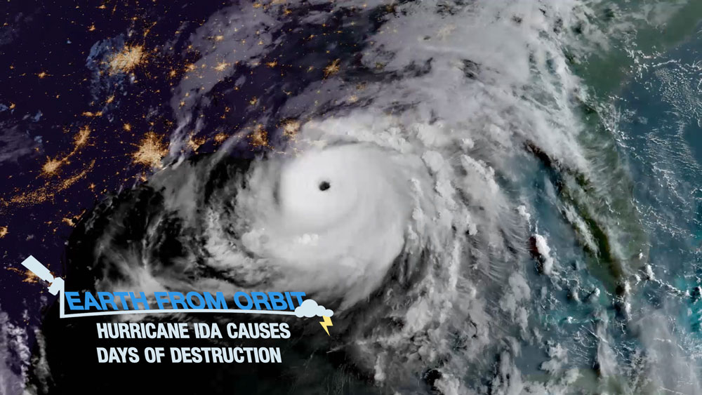
Over the past week, Hurricane Ida has caused intense flooding and destruction from the Gulf of Mexico to New England, and is blamed for several fatalities. Ida struck Louisiana near Port Fourchon on August 29 as a powerful Category 4 storm, with maximum sustained winds of 150 miles per hour. The storm made landfall in Louisiana on the 16th anniversary of Hurricane Katrina, and is tied with 2020’s Hurricane Laura and the Last Island Hurricane in 1856 for the strongest maximum sustained winds at landfall for a Louisiana hurricane. In just three days, Ida rapidly progressed from a tropical wave to a hurricane. After striking Cuba’s Isle of Youth as a Category 1 hurricane on August 27, Ida headed northward and rapidly intensified to a Category 4 hurricane. Ida moved inland and brought heavy rainfall and widespread flooding from the Tennessee and Ohio Valleys into the Central and Southern Appalachians and mid-Atlantic, bringing record rainfall and deadly flooding to the New York region. NOAA satellites monitored the progression of the storm as it developed and intensified.
September
-
August 12, 2021: Earth from Orbit: Hurricane Season Heats Up
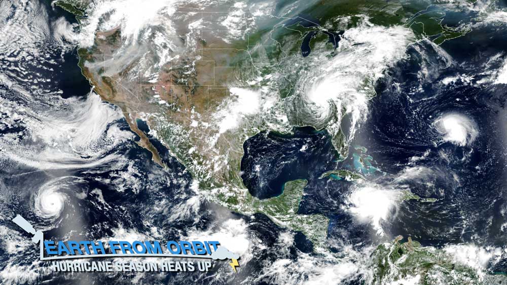
As we approach the peak of Atlantic hurricane season, activity in the tropics is ramping up. NOAA satellites are monitoring storms in both the Atlantic and Pacific Oceans. Tropical Storm Fred formed on Aug. 11, 2021 and made landfall on the eastern Florida panhandle on Aug. 16. Tropical Storm Grace developed on Aug. 14 in the Caribbean Sea and strengthened into a hurricane on Aug. 18 as it approached Mexico’s Yucatan Peninsula. And Tropical Storm Henri developed south of Bermuda on Aug. 16. Meanwhile, hurricane Linda churns in the eastern Pacific. As hurricane season heats up, NOAA satellites provide critical data for forecasting and tracking the location, movement and intensity of the storms.
-
August 12, 2021: Earth from Orbit: Fires Rage Across the Globe
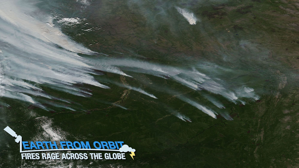
As wildfires continue to rage in North America, and the Dixie Fire became the second largest in California history, fire activity has also spiked across the globe. Thick smoke from the hundreds of wildfires burning in Siberia has reached parts of Mongolia, western Greenland, and, for the first time in recorded history — the North Pole. Hundreds of fires are also raging in Greece, Italy, Algeria and Turkey among one of the worst heat waves in decades. NOAA’s satellites and those from our partners across the globe are providing critical data for detecting and tracking the hundreds of fires that are burning worldwide as well as monitoring reduced visibility and air quality from the smoke produced by the blazes. These observations aid forecasters, decision-makers, and first responders.
-
August 2, 2021: Seeing the Sun in a New Light
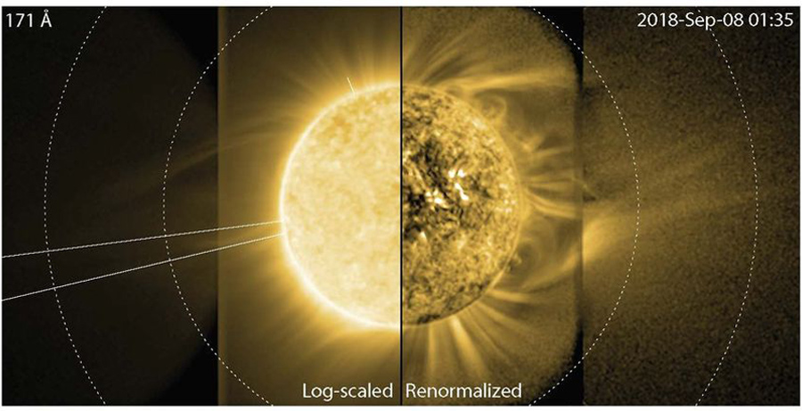
The SUVI experimental enhanced coronal imaging study provided the first-ever imagery of the sun’s elusive middle corona in extreme ultraviolet (EUV) light. These observations revealed the structure, temperature, and nature of EUV emissions from this region. Credit: Dan Seaton, CIRES/NCEI Using the GOES-17 Solar Ultraviolet Imager (SUVI) in a novel way, Cooperative Institute for Research in Environmental Sciences (CIRES) researchers at NOAA’s National Centers for Environmental Information captured the first-ever images of dynamics in the sun’s elusive middle corona. These SUVI observations reveal how the middle corona influences the solar wind and eruptions from the sun, a finding that could improve space weather forecasting. The study was published in Nature Astronomy on August 2, 2021.
August
July
-
July 30, 2021: Second Quarter 2021 GOES-R/GeoXO Newsletter
GOES-T undergoes electromagnetic testing. Credit: Lockheed Martin The GOES-R/GeoXO quarterly newsletter for April – June 2021 is now available. It has been an eventful quarter for the GOES-R/GeoXO Program. GOES-T is finishing up testing in preparation for its shipment to the launch site this fall, while critical activities to test communications between the satellite and ground system and rehearse launch procedures continue. GOES-16 and GOES-17 provided critical data for recent severe weather, wildfire, and tropical storm/hurricane events. GeoXO completed its first technical review and is moving forward into the concept and technology development phase of the mission. We issued the RFP for the GeoXO sounder instrument, as well as RFIs for the spacecraft and ocean color and lightning mapping instruments. As we work toward completing the GOES-R mission, we are also full steam ahead on bringing GeoXO to fruition.
-
July 29, 2021: Earth from Orbit: Wildfires Spawn Severe Weather
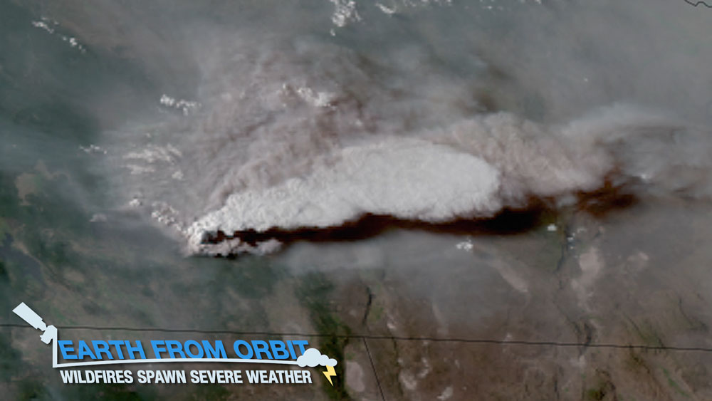
Wildfires continue to rage in the western U.S. Some of the fires are so intense, they’re creating their own severe weather. NOAA satellites are monitoring wildfire conditions as well as fire-generated storms. Intense heating by wildfires can generate a smoke-infused thunderstorm or pyrocumulonimbus cloud. These clouds can produce lightning and generate strong winds, making it more difficult to contain the spread of fire. In rare instances, they can even spawn a tornado. The Bootleg Fire in Oregon produced a tornado on July 18, 2021. When wildfires spawn severe weather, dangerous conditions become even worse. NOAA satellites are our eyes in the sky, detecting and monitoring wildfires as well as storms created by the most intense fires.
-
July 28, 2021: Satellite Data Predict Future Lightning Strikes
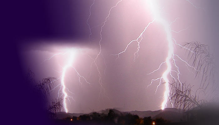
Lightning is a major hazard. It’s a significant threat to life and property, can ignite wildfires, and impacts travel. Lightning can strike at any time, but it is most common in the summer months. The GOES-R Geostationary Lightning Mapper (GLM), the first instrument of its kind in geostationary orbit, has revolutionized lightning detection. Now, GLM can not only detect current lightning activity, but its data can also help predict the occurrence of lightning in the future. To accomplish this, a sophisticated machine-learning algorithm was trained, using GLM data, to recognize complex patterns in GOES-R Advanced Baseline Imager (ABI) imagery that often precede lightning activity detected by GLM. The new tool can accurately predict lightning up to 60 minutes before the first observation of lightning flashes.
-
July 23, 2021: Earth from Orbit: Satellites and Solar Energy
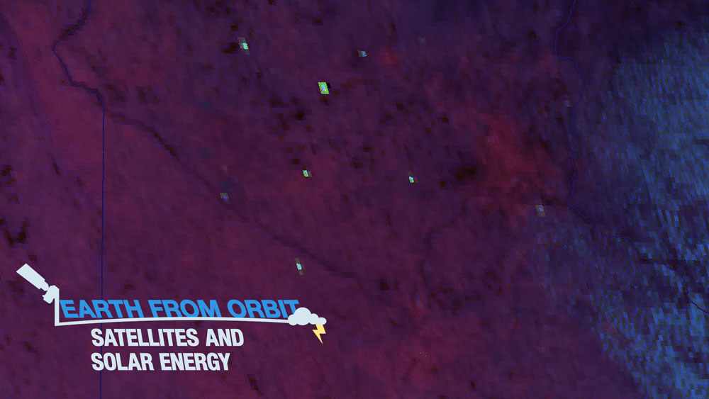
Sunglint from solar panels is often observed in satellite imagery. While an interesting phenomenon to see, there’s actually an important connection between satellite observations and solar energy production. Detailed data about clouds from NOAA satellites can aid solar energy forecasts. Clouds affect the output of solar power generation systems. GOES-16 (GOES East) and GOES-17 (GOES West) monitor what types of clouds are present, how they are distributed in the sky, how much shadow they are creating over solar farms, and where they will move next. This provides valuable information about the variations that can occur in power production over the next few minutes to hours. As demand for solar energy grows, the need for timely, detailed information about solar radiation and cloud cover is essential. GOES-16 and GOES-17 provide critical data for harnessing solar energy and efficiently delivering it to consumers.
-
July 15, 2021: Earth from Orbit: Wildfire Smoke Blankets U.S.
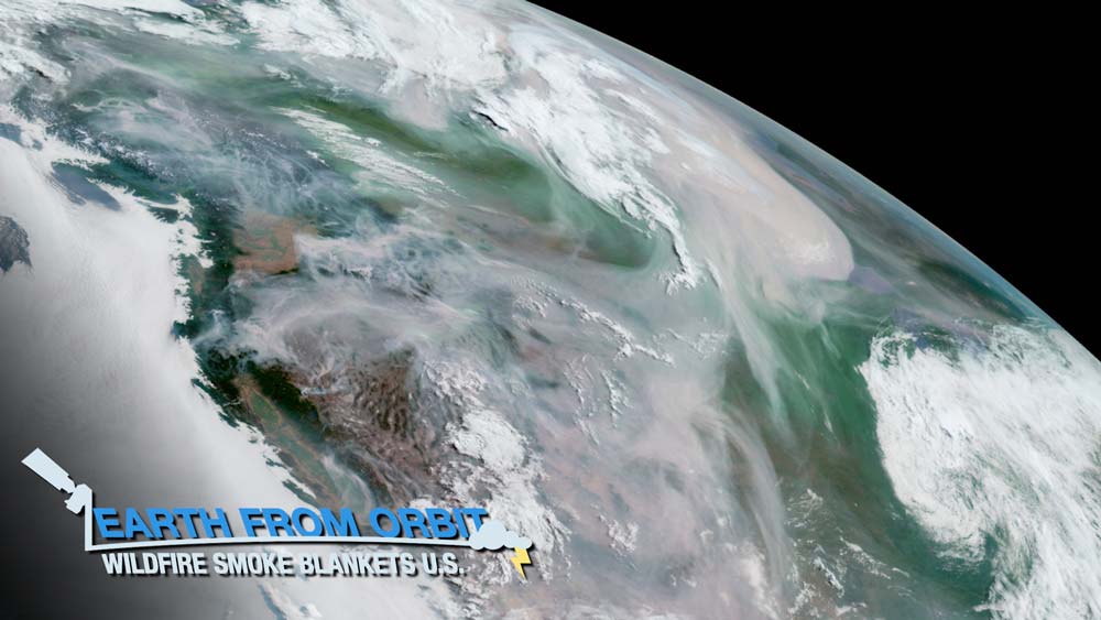
Wildfire activity amid extreme heat and drought has resulted in smoke blanketing much of the United States and Canada. NOAA satellites are monitoring the fires and their smoke output as well as the effects of the smoke on air quality, visibility, and weather. The satellite data are critical for forecasters, decision-makers, and first responders.
-
July 1, 2021: Earth From Orbit: Record Heat and Drought Raising Risk of Wildfire
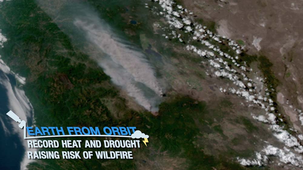
The western U.S. has seen record-breaking high temperatures over the past week as a heat dome, or mass of warm air, blankets the Pacific Northwest. This essentially occurs when a “mountain” or “dome” of warm air rises into the atmosphere, gets pinched off by the jet stream, and blocks new weather systems from moving in. The extreme heat, coupled with a severe drought this spring and summer in the region, has combined to significantly raise the risk of wildfire from both human and natural hazards, such as lightning. As the drought and heat wave stretches on, vegetation in these areas dries out, creating ample fuel for potential wildfires. But how dry is it? Learn how NOAA satellites help monitor fires and fire weather conditions that can lead to increased likelihood of them occurring.
-
June 24, 2021: NOAA Announces Post-Launch Plans for GOES-T Satellite
Fully Assembled GOES-T Satellite NOAA’s GOES-T will replace GOES-17 in the GOES West position, following a successful launch and checkout period, top NOAA officials announced. The decision to place GOES-T into operational service as soon as possible after launch is a result of the blockage in the loop heat pipe of the Advanced Baseline Imager (ABI), the key instrument on GOES-17.
-
June 24, 2021: Earth From Orbit: Tropical Storm Claudette Batters Southeastern U.S
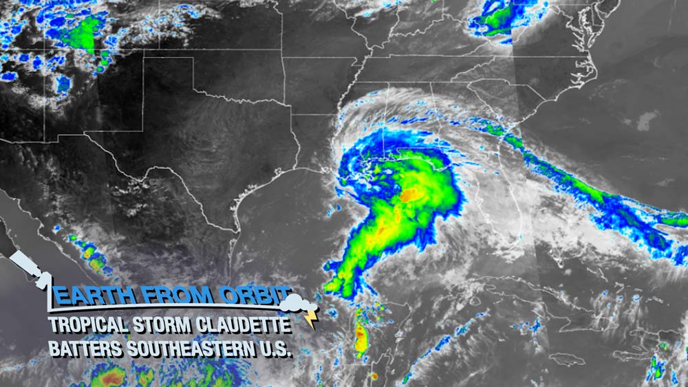
This past weekend, NOAA satellites closely monitored Tropical Storm Claudette, the third named storm of the 2021 Atlantic hurricane season. Claudette slammed into the Gulf and southeastern coasts of the U.S., causing severe damage in parts of the Deep South. The storm was officially named on June 19 after it organized and strengthened near the town of Houma in southeastern Louisiana. It is the fifth-earliest third-named storm to form in the Atlantic basin since 1950.
-
June 17, 2021: Earth from Orbit: Fire Season Heats Up
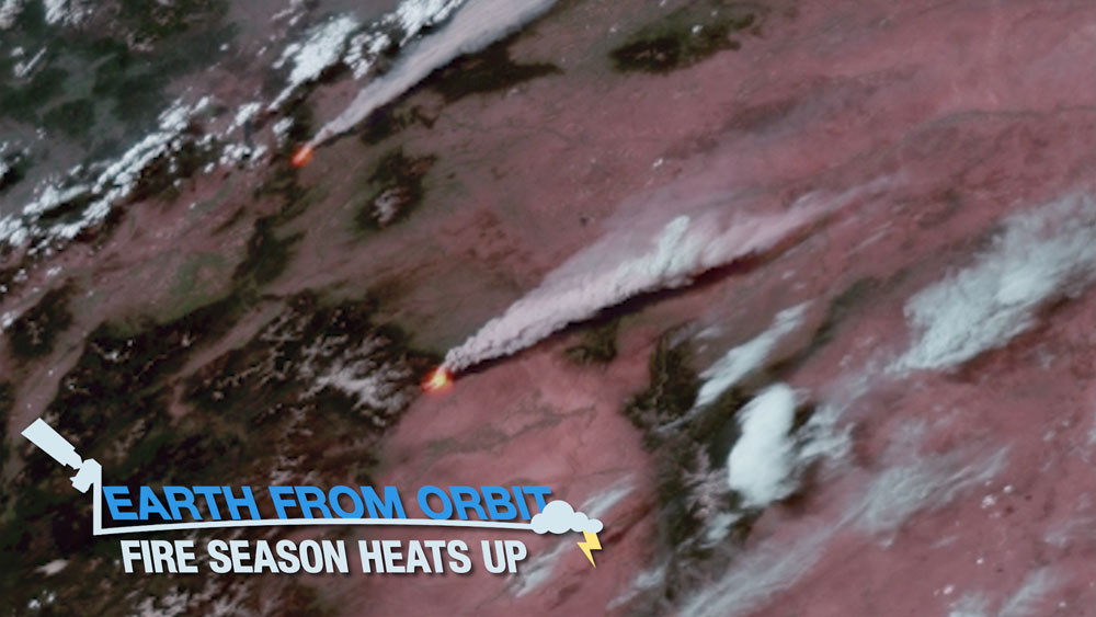
Fire weather is heating up across the western United States, exacerbated by an intense heatwave and ongoing severe drought. NOAA satellites are monitoring numerous wildfires and keeping watch on areas primed for ignition. As of June 17, 2021, 33 large fires are currently active, burning more than 400,000 acres in 10 states. NOAA satellites zoomed in on several of the major fires burning in the western U.S, including the Telegraph and Mescal Fires in southeastern Arizona, Pack Creek and Bear Fires in Utah, and the Robertson Draw Fire in Montana. Data from the satellites help forecasters monitor drought conditions, locate hot spots, detect changes in a fire’s behavior, predict a fire’s motion, and monitor smoke and air quality.
-
June 10, 2021: Earth from Orbit: Actinoform Clouds
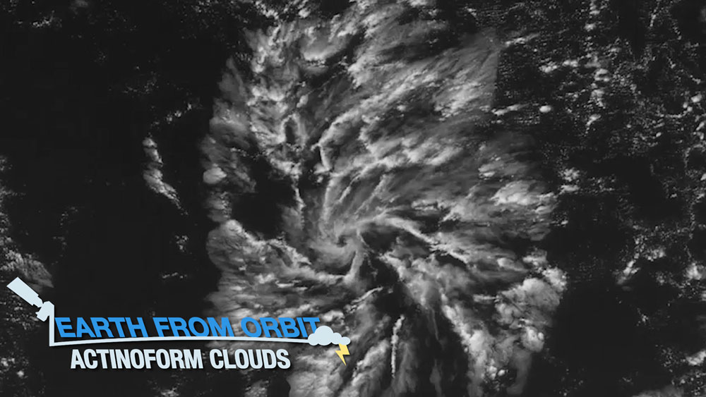
NOAA satellites captured actinoform clouds over the eastern Pacific Ocean on June 3, 2021. These collections of shallow clouds, organized in a distinctive radial pattern, often appear as leaf-like or reminiscent of wagon wheel spokes. They are commonly observed over open water in the Pacific Ocean, in areas where stratocumulus clouds form. These cloud formations are usually so large that they cannot be seen from below. They were first observed in 1962, by NASA’s TIROS V satellite. It’s not yet clearly understood how these complex clouds organize, and studying these clouds with NOAA’s advanced satellite sensors may lead to important new insights about our atmosphere.
-
June 3, 2021: Earth from Orbit: 2021 Hurricane Season Has Begun
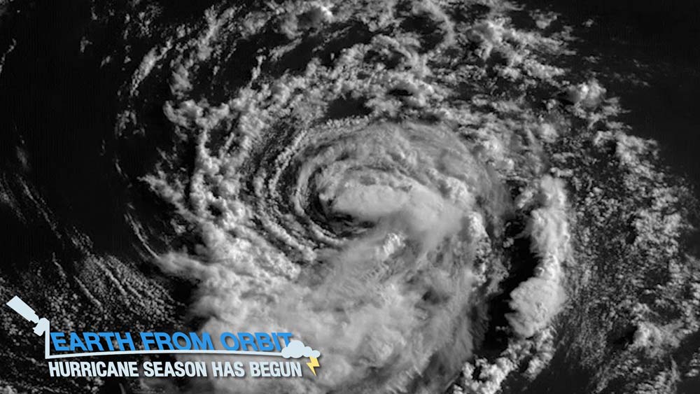
The 2021 hurricane season is officially underway. June 1 marked the beginning of the Atlantic hurricane season; the eastern Pacific season began on May 15. 2020’s Atlantic season was the busiest on record with a total of 30 named storms, including 13 hurricanes. And NOAA is predicting another above-average Atlantic season for 2021. NOAA satellites provide vital information for forecasting hurricanes and monitoring the location, movement and intensity of storms. As hurricane season gets underway, NOAA satellites are vigilantly watching over the Atlantic and eastern Pacific hurricane basins.
June
-
May 20, 2021: NOAA Predicts Another Active Hurricane Season
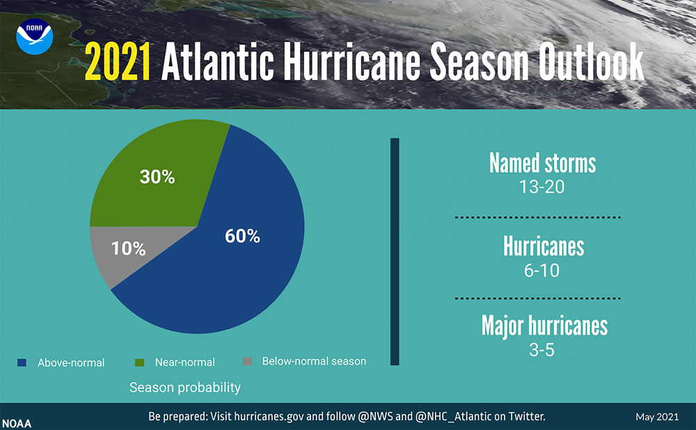
A summary infographic showing hurricane season probability and numbers of named storms predicted from NOAA's 2021 Atlantic Hurricane Season Outlook. Credit: NOAA NOAA’s Climate Prediction Center is predicting another above-normal Atlantic hurricane season. Forecasters predict a 60% chance of an above-normal season, a 30% chance of a near-normal season, and a 10% chance of a below-normal season. However, experts do not anticipate the historic level of storm activity seen in 2020. For 2021, a likely range of 13 to 20 named storms (winds of 39 mph or higher), of which 6 to 10 could become hurricanes (winds of 74 mph or higher), including 3 to 5 major hurricanes (category 3, 4 or 5; with winds of 111 mph or higher) is expected. NOAA provides these ranges with a 70% confidence. The Atlantic hurricane season extends from June 1 through November 30.
-
May 20, 2021: Earth from Orbit: Supercells Strike Louisiana and Texas
Severe storms struck Louisiana and Texas on May 17, 2021, producing heavy rain, extensive flooding, damaging winds, large hail, and several tornadoes. Hail the size of baseballs was reported near Girard, Texas, and wind gusts of more than 70 mph downed trees and damaged buildings. Torrential rain fell over parts of eastern Texas and Louisiana, producing widespread flooding. At least four people died amid floodwaters after more than a foot of rain fell in Lake Charles and 10 inches in Baton Rouge. GOES-16’s orbit allows the satellite to keep vigilant watch over a fixed area and capture storms in motion. The ability to monitor clouds and atmospheric conditions in near-real time helps forecasters track rapidly changing weather conditions and give advance warning of severe thunderstorms, tornadoes, and flooding.
-
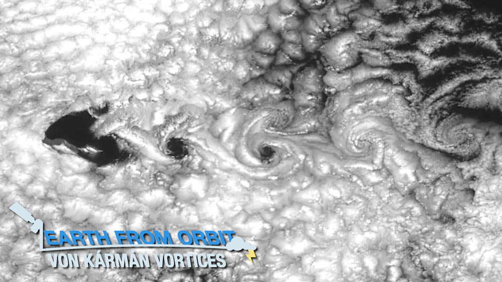
May 13, 2021: Earth from Orbit: von Kármán Vortices
On May 8, 2021, NOAA satellites captured von Kármán vortices streaming around Guadalupe Island, off the west coast of Mexico’s Baja California. These cloud formations often occur over the ocean when islands disrupt the flow of the wind. This disruption creates spiral patterns in the clouds. The pattern of the cloud swirls depends on the wind intensity. NOAA satellites and those from NASA and our international partners observe this phenomenon all over the world. When von Kármán vortices form, satellites capture them in stunning detail.
-
May 6, 2021: Texas Dry Line Drives Storms

Severe storms struck Texas on May 3, 2021. They formed along a dry line, where moist air from the Gulf of Mexico met dry air from the Desert Southwest. The storms generated strong straight-line winds, hail, and tornadoes. A variety of GOES-16 and GOES-17 imagery shows the severity of the storms. When severe weather strikes, GOES keep a watchful eye to help identify intensifying storms and track rapidly changing weather conditions.
May
-
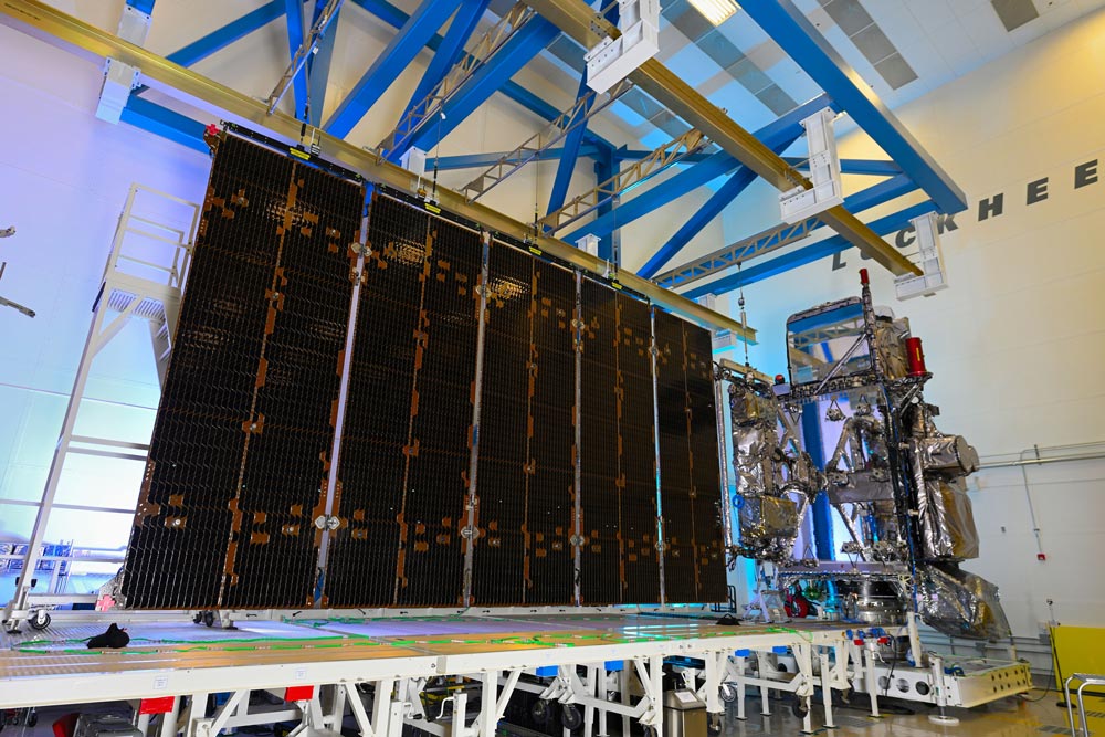
April 23, 2021: GOES-T Completes Solar Array Deployment Test
Engineers conduct the GOES-T solar array deployment test. Credit: Lockheed Martin On March 3, 2021, engineers completed a successful test deployment of the GOES-T solar array as part of a series of tests to prepare the satellite for a planned December 2021 launch. This critical test verified that the satellite's large, five-panel solar array — which is folded up when the satellite is launched — will properly deploy when GOES-T reaches geostationary orbit. During this test, engineers unfurled the five panels on rails that simulated the zero-gravity environment of space. Once in orbit, the deployed solar panels will form a single solar array wing to power the satellite using energy from the sun.
-
April 22, 2021: Earth from Orbit: Every Day is Earth Day for NOAA Satellites
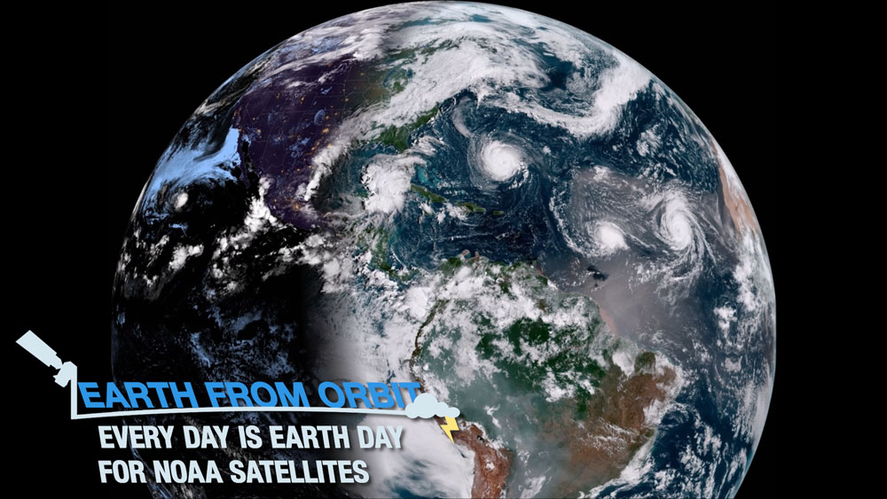
To celebrate Earth Day, we are sharing stunning views of our beautiful planet, captured by NOAA satellites. Every day, NOAA satellites provide critical information that keeps us informed and helps us stay safe. From our satellites, we see cloud patterns, severe weather, lightning, hurricanes, ice and snow cover, phytoplankton blooms, fires, dust storms, and more. At NOAA, every day is Earth Day.
-
April 15, 2021: Earth from Orbit: La Soufrière Erupts
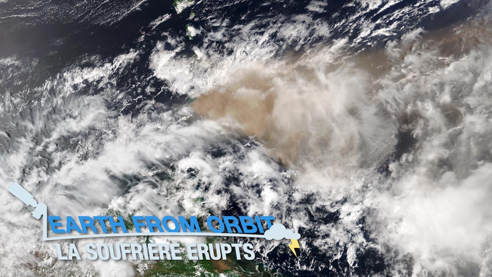
“This Week in Weather” is now “Earth from Orbit.” We’ve updated the name of our weekly video series to better reflect NOAA satellites’ vast capabilities that extend beyond weather.
On the morning of April 9, 2021, La Soufrière volcano on the Caribbean island of Saint Vincent began erupting, spewing ash at least 25,000 feet in the air. The volcano continued to erupt over the next several days, with multiple violent explosions. NOAA satellites captured stunning imagery of the eruptions and provided critical monitoring of the resulting volcanic emissions and ash clouds.
-
April 13, 2021: First Quarter 2021 GOES-R/GEO-XO Newsletter
GOES-T completed a successful solar array deployment test. Credit: Lockheed Martin The GOES-R/GEO-XO quarterly newsletter for January – March 2021 is now available. It’s launch year, and our pace and energy are increasing! It’s hard to say what is more remarkable: that in 2021 we are still dealing with the pandemic, or that the pandemic has barely affected our progress. Despite the challenges, the GOES-R/GEO-XO team continues to perform critical work for our nation. GOES-T completed environmental testing and is on track to launch in December. We are moving forward with the GEO-XO Program. We awarded two Phase A Study contracts for the imager and are planning for the Mission Concept Review in June, which will affirm the need for the mission. GOES-16 and GOES-17 provided critical data for recent severe weather, fire, and dust storm events. Our program continues to do a remarkable job of advancing the mission.
-
April 8, 2021: This Week in Weather: Gravity Waves
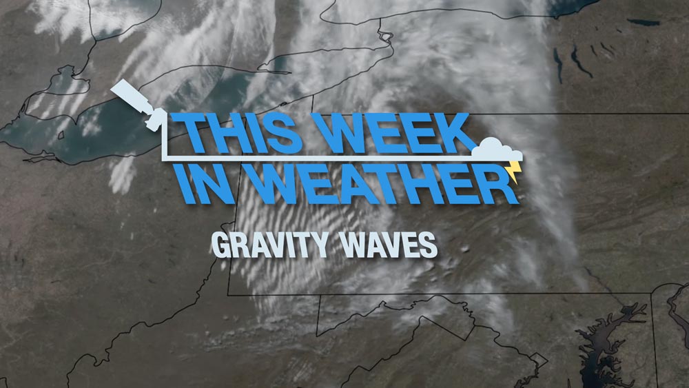
![Title slide for video with the text: This Week in Weather: Gravity Waves transposed over a satellite scene of gravity waves over Western Pennsylvania.]()
This Week in Weather: Gravity Waves On April 3, 2021, NOAA’s GOES-16 and NOAA-20 satellites viewed gravity waves rippling over Western Pennsylvania. Waves form in the atmosphere when air is disturbed, like a stone dropped into a calm pond. The gravity waves seen over Pennsylvania were caused by air being forced upward by hills into a layer of stable air. Gravity causes the air to fall back down, and it begins to oscillate, creating a ripple effect. Learn more about gravity waves in our latest “This Week in Weather” video.
-
April 6, 2021: What Causes Tides?
![Drawing of Earth as seen from Space against a blue background with ribbons of lighter blue color and the text What Causes Tides?]()
What Causes Tides? If you’ve ever spent a day at the beach, you’ve probably noticed that the ocean water is constantly moving. Waves cause the ocean to move all day long. And tides cause the ocean to rise and fall twice each day. But what exactly causes high tides and low tides? Learn more in a new video from NOAA SciJinks!
April
-
March 31, 2021: NASA awards GEO-XO Imager Phase A study contracts
On March 31, 2021, NASA awarded GEO-XO Imager (GXI) Phase A Study contracts to L3Harris Technologies, Inc., and Raytheon Company. These definition-phase study and design development contracts are part of instrument formulation activities for the geostationary satellite mission that will follow GOES-R, GEO-XO. Each company will conduct a one-year study to develop an infrared and visible imaging instrument concept and mature necessary technology. These studies will help define the imager’s potential performance, risks, costs, and development schedule. GEO-XO will be operational in the early 2030s, as the GOES-R mission reaches the end of its lifetime.
-
March 24, 2021: This Week in Weather: Severe Storms Strike Southern U.S.
![This Week in Weather: Severe Storms Strike Southern U.S.]()
This Week in Weather: Severe Storms Strike Southern U.S. From March 17-18, 2021, a severe weather outbreak swept across the Southern U.S. The storms produced damaging winds, large hail, and dozens of tornadoes, including significant EF2 tornadoes in Mississippi and Alabama. Throughout the event, GOES-16 (GOES East) monitored conditions and tracked the storms in real time. The satellite provided important information on cloud properties, storm structure, and lightning activity within the storms.
-
March 22, 2021: GOES-T Completes Critical Testing in Preparation for December 2021 Launch
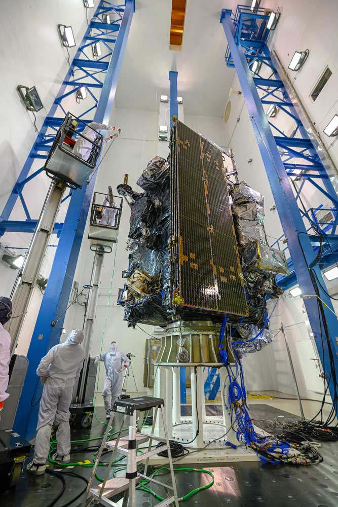
![GOES-T acoustic testing. Credit: Lockheed Martin]()
GOES-T acoustic testing. Credit: Lockheed Martin NOAA’s GOES-T satellite recently completed a series of rigorous tests to ensure it can withstand the harsh conditions of launch and orbiting 22,236 miles above Earth. In addition, the mission operations team conducted critical activities to test communications between the satellite and ground system and rehearse launch procedures. GOES-T is on track for a December 2021 launch.
-
March 18, 2021: This Week in Weather: Late-Season Snowstorm Breaks Records
![This Week in Weather: Late-Season Snowstorm Breaks Records]()
This Week in Weather: Late-Season Snowstorm Breaks Records A late-season snowstorm dropped feet of snow in parts of Colorado, Wyoming, Nebraska, and South Dakota from March 13-14, 2021. Record-breaking snowfall was measured in Cheyenne, Wyoming and Denver, Colorado. NOAA’s geostationary satellites, GOES-16 (GOES East) and GOES-17 (GOES West), and polar-orbiting NOAA-20 and Suomi-NPP satellites monitored a low-pressure system in the region and followed its evolution into an historic storm. The satellites allowed scientists to forecast the storm’s path and intensity while providing early warning. They also kept watch throughout the event, monitoring the progression of the storm and resulting snow cover.
-
March 11, 2021: This Week in Weather: Tracking Fires from Space
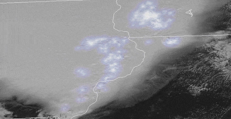
![This Week in Weather: Tracking Fires from Space]()
This Week in Weather: Tracking Fires from Space From March 7-9, 2021, NOAA satellites monitored numerous fires over the Southern Plains. GOES-16 (GOES East) observed these fires in near-real time. By keeping constant watch over the same area, GOES-16 helps to locate fires, detect changes in a fire’s behavior, and predict its motion. The NOAA-20 satellite captured high-resolution imagery of the fires on March 9. This satellite’s VIIRS instrument has an imager band with high spatial resolution, at 375 meters per pixel, which allows it to detect smaller, lower temperature fires. Together, the satellites monitored both the hot spots and smoke plumes from the fires. Satellites allow for detecting and monitoring a range of fires, providing information about the location, duration, size, temperature, and power output of those fires that would otherwise be unavailable.
-
March 4, 2021: This Week in Weather: Superior Flow of Clouds
![Video title over blurred satellite scene of clouds over Lake Superior]()
This Week in Weather: Superior Flow of Clouds On March 1, 2021, NOAA satellites monitored lake-effect clouds flowing over Lake Superior. The satellites captured light snow bands embedded in the clouds. Lake-effect snow occurs when very cold air moves over the warmer waters of a lake. GOES-16 viewed the clouds in motion and tracked convection within them, while NOAA-20 captured the scene in stunning detail when the satellite passed over that afternoon. Specialized GOES-16 imagery distinguished snow/ice (white) from the clouds (yellow). GOES-16 and NOAA-20 work together to provide critical information about clouds for weather forecasts and warnings.
-
March 3, 2021: The Most Extreme Weather in America
![large gray storm cloud with blue and white splotches indicating lightning flashes within the storm.]()
Derecho captured by GOES-16 on August 10, 2020. North America is home to several different climate types. That means the continent is also home to a variety of extreme weather events. Although we experience the effects of extreme weather here on Earth’s surface, weather satellites can collect some pretty wild pictures and information about extreme weather from above. Meteorologists use this important information to warn us about extreme weather heading our way. This new article from NOAA SciJinks highlights a few of the most extreme weather events captured over the past few decades by NOAA's GOES satellites.
-
March 1, 2021: 5 Things: Space Weather, Explained
5 Things: Space Weather, Explained Just like we experience weather on Earth, there’s weather in space! The Sun may look very constant and quiet from Earth, but it's constantly spewing out a stream of particles called the solar wind. Space weather is activity on the Sun that can affect Earth and interact with our technology. Part of NOAA’s mission is to monitor space weather and provide timely, accurate warnings to help our nation prepare for and minimize the extent of economic loss and human hardship. This new video highlights NOAA’s space weather mission, including observations from GOES-16 and GOES-17.
March
-
February 25, 2021: This Week in Weather: Tracking Dust in the Wind
NOAA satellites monitored a large plume of Saharan Dust Feb. 17-22, 2021. The GOES-R Program, in partnership with the JPSS program, NESDIS, NASA Goddard, and CIRA, debuted a new video series on Feb. 25, 2021, “This Week in Weather,” which will highlight a significant weather or environmental event each week. Our inaugural video, “Tracking Dust in the Wind,” examines a Saharan dust event. From Feb. 17–22, 2021, NOAA satellites monitored a large plume of dust from the Sahara Desert as it traveled off the west coast of North Africa and across the Atlantic Ocean. The Saharan Air Layer (SAL), a mass of dry, dusty air that forms over the Sahara Desert, can transport dust far away from the Sahara throughout the year. NOAA satellites like the geostationary GOES-16 and GOES-17 and the polar-orbiting NOAA-20 and NOAA/NASA Suomi-NPP help forecasters and scientists to continuously monitor the evolution of SAL outbreaks and their effects on the meteorology and climatology of the tropical North Atlantic. NOAA satellites also track aerosols associated with dust storms. Aerosol data from NOAA satellites inform air quality alerts and help air traffic controllers monitor visibility for pilots.
-
February 24, 2021: GOES-R/JPSS Hands-on Training to Process, Display, and Analyze Satellite Data Products
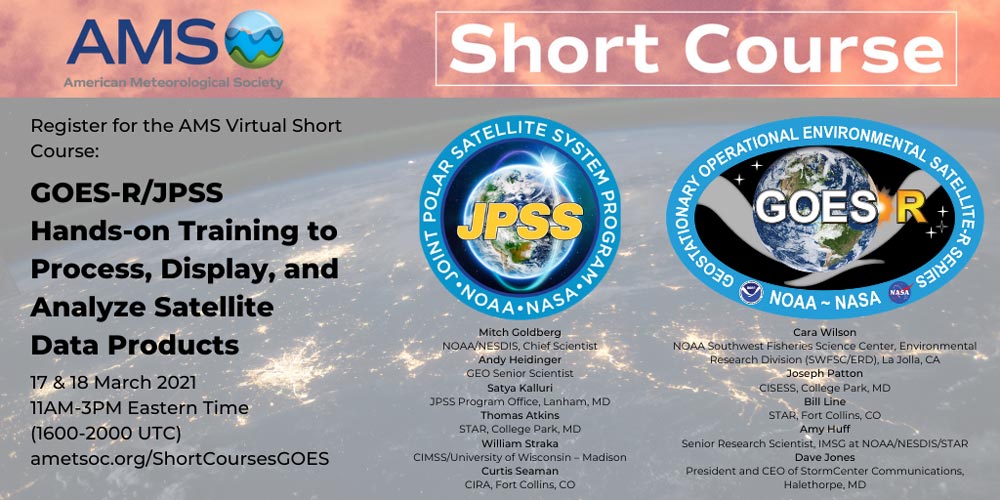
![GOES-R and JPSS logos with short course information: course will be held March 17 and 18 2021 from 11 a.m. to 3 p.m. Eastern Time. A list of speakers is included, which can be found at ametsoc.org/ShortCoursesGOES]()
GOES-R/JPSS Short Course, March 17 and 18, 2021. Interested in learning how to process, display, and analyze GOES-R and JPSS satellite data? Join our virtual American Meteorological Society (AMS) short course on March 17 and 18, 2021, from 11 a.m. to 3 p.m. ET. Our subject matter experts will show how to use satellite data products to analyze specific environmental scenarios such as severe convection, tropical storms, flooding, fire weather, air quality, and more. Register for the short course here.
-
February 19, 2021: Five Questions for Kevin Fryar
![headshot of Kevin in front of a GOES-R launch poster]()
GOES-R chief of staff Kevin Fryar For Black History Month, NOAA Satellites sat down with Kevin Fryar, chief of staff at GOES-R, to talk about his formative experiences as an African American in the sciences, along with advice for budding meteorologists of color. A veteran of the U.S. Air Force with over twenty years of experience as a weather decision support specialist, Fryar has also served at both the National Weather Service (NWS) and National Environmental Satellite and Data Information Service (NESDIS/NOAA Satellites) in a variety of roles. Most recently, he has been instrumental in the development of the new GeoXO satellite system (a ground-breaking mission that will advance Earth observations from geostationary orbit), advising on key issues related to disaster preparedness and management. During his interview, Fryar gave an overview of GOES-R’s newest initiative as well as some practical advice on how his military and on-the-job experience made all of the difference in his career.
-
February 12, 2021: NESDIS Looks Back at 2020
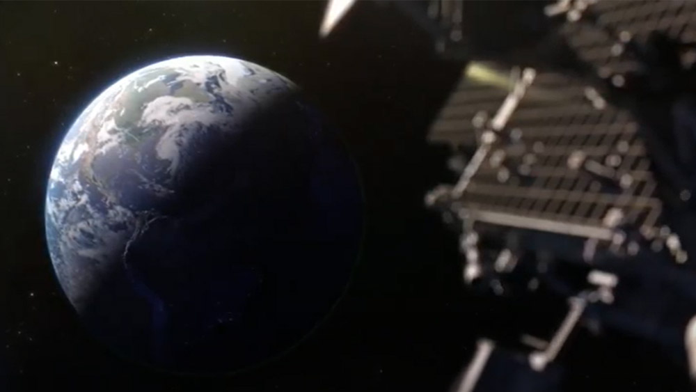
![Satellite in space looks down on Earth]()
GOES-16 and GOES-17 contributed to NESDIS' success in 2020 2020 will be remembered as a time of unprecedented challenges and changes. These circumstances inspired us to push our boundaries and try new things so that we could provide the nation with the most accurate and timely environmental observations with critical expertise. Learn more about our 2020 accomplishments and how our satellites help protect life and property.
-
February 11, 2021: NOAA Virtual Open House
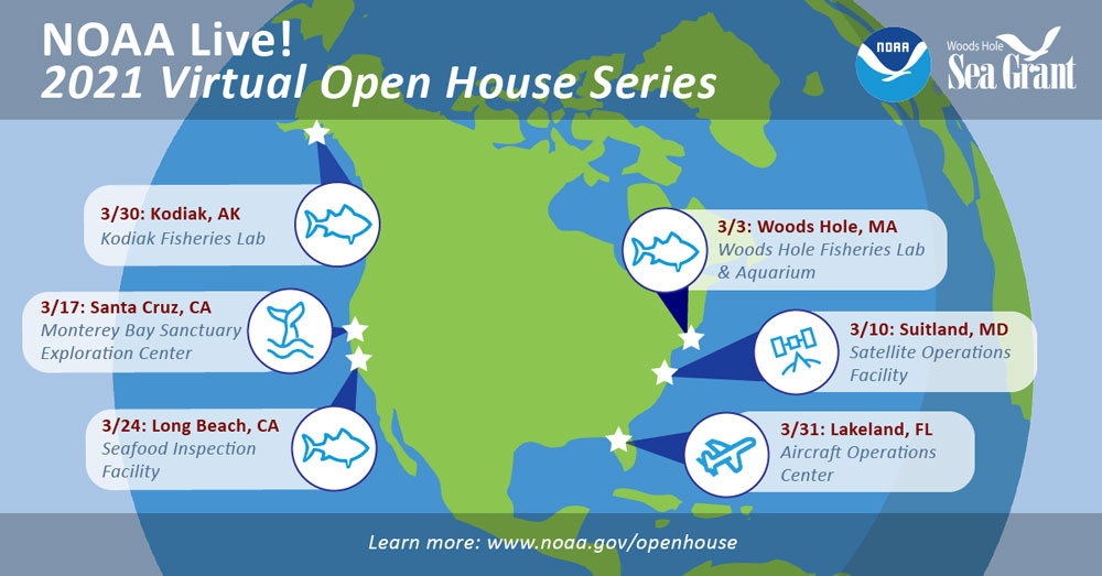
![March 3: Wood Hole, Massachusetts Fisheries Lab and Aquarium | March 10: NOAA Satellite Operations Facility, Suitland, Maryland | March 17: Monterey Bay, California Sanctuary Exploration Center | March 24: Long Beach, California Seafood Inspection Center | March 30: Kodiak, Alaska Fisheries Lab | March 31: Lakeland, Florida NOAA Aircraft Operations Center]()
NOAA Live! 2021 Virtual Open House Serie Join us in March for a NOAA Live! Virtual Open House and “visit” some of the places where NOAA science happens. Each week, we’ll tour a different NOAA facility through a live webinar and meet the staff that bring NOAA’s mission to life. Our guides will highlight a few cool spots around campus and answer your questions in real time. These free events are geared toward students in grades 2 through 8, and they’re perfect for classrooms and families. Registration is limited so sign up today!
February

-
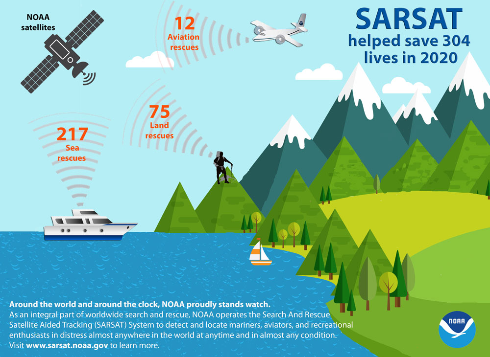
January 28, 2021: NOAA Satellites Helped Save 304 Lives in 2020
![Outdoor scene showing blue water with boats, green land with trees, hills, and gray mountains with white snow caps. A hiker is stranded at the top of one of the hills. In the blue sky is an airplane and a satellite.]()
Of the 304 lives saved in 2020, 217 people were rescued at sea, 12 were rescued from aviation incidents and 75 were rescued from incidents on land. Credit: NOAA NOAA’s satellite fleet, renowned for being the backbone of weather forecasts, also played a pivotal role in rescuing 304 people from potentially life-threatening situations throughout the United States and its surrounding waters in 2020 through other capabilities that fly on these satellites. NOAA’s polar-orbiting and geostationary satellites are part of the global Search and Rescue Satellite Aided Tracking system, or COSPAS-SARSAT, which uses a network of U.S. and international spacecraft to detect and locate distress signals sent from emergency beacons from aircraft, boats and handheld Personal Locator Beacons (PLBs) anywhere in the world.
-
January 19, 2021: Fourth Quarter 2020 GOES-R/GeoXO Newsletter
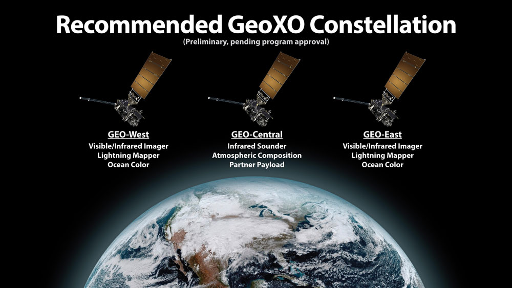
![Three satellites hover above an image of Earth against a black background, showing the relative positions of the recommended GeoXO constellation.]()
Recommended GeoXO constellation The GOES-R/GeoXO quarterly newsletter for October – December 2020 is now available. 2020 was an unforgettable year – for all the wrong reasons. Besides COVID-19 and social injustice, both of which affected the GOES-R/GeoXO family, last year also brought a record-breaking Atlantic hurricane season and a record-smashing western wildfire season. As usual, our team rose to the challenge and delivered the mission. GOES-16 and GOES-17 continue to provide critical data to forecasters and GOES-T is in test preparing for a December launch. We’re also planning for the future beyond GOES-R. We’ve renamed the mission Geostationary Extended Observations (GeoXO) to better reflect the advanced observations of atmosphere and ocean we plan for the GeoXO constellation. We are looking forward to the GeoXO Mission Concept Review in March and formalizing the program.